Skip to content
Stone church facade and grounds at Mission San José in San Antonio

South Texas Plains · Historic Sites & Museums

San Antonio Missions National Historical Park

Four Spanish colonial mission communities south of downtown San Antonio—Concepción, San José, San Juan and Espada—preserved along the San Antonio River as living parish, architectural and cultural landscapes connected to the city's UNESCO World Heritage story.

Photography: Dgdrby · CC BY-SA 4.0 · Wikimedia Commons

Plan the visit

San Antonio Missions National Historical Park at a glance

Where is San Antonio Missions National Historical Park?
San Antonio Missions National Historical Park is near San Antonio, Texas, in Bexar County.
When is the best time to visit San Antonio Missions National Historical Park?
Fall through spring for comfortable walking and biking; summer visits are best early in the day with shade and water built into the route
Do I need to plan ahead for San Antonio Missions National Historical Park?
The national historical park is free and no entrance pass is required. The four NPS mission sites are spread along the river corridor, and their churches remain active parishes, so services, ceremonies or preservation work can temporarily affect church access. Allow several hours to see more than one mission.
Who manages San Antonio Missions National Historical Park?
National Park Service

The place

Why San Antonio Missions National Historical Park belongs on the list

San Antonio Missions National Historical Park is best understood as a connected cultural landscape rather than a single monument. The National Park Service preserves four missions—Concepción, San José, San Juan and Espada—south of downtown, while the Alamo forms the fifth San Antonio mission in the broader UNESCO World Heritage designation. Together they show how Spanish colonial settlement, Indigenous communities, agriculture, religion and water management reshaped the river corridor.

Mission San José is the most useful first stop because it has the park's main visitor center and one of the largest, most complete mission compounds. The stone church, defensive walls, granary and reconstructed rooms make it easier to understand the mission as a community rather than only a church facade. Ranger information here can also help visitors decide how much of the larger corridor fits into the day.

Concepción, San Juan and Espada each add something different. Concepción is known for its remarkably intact church and architectural fabric. San Juan emphasizes agriculture and the mission landscape, while Espada connects visitors with the southern reach of the historic acequia system. Seeing all four reveals how mission communities were spaced along the river rather than clustered in one downtown district.

The San Antonio River is the thread tying the sites together. Mission Reach trails make walking and bicycling a practical alternative to driving portions of the corridor, and the restored river landscape gives the trip an outdoor dimension that the downtown Alamo cannot provide. Heat and distance matter, however, so cyclists and walkers should plan water, turnaround points and daylight conservatively.

These are also active religious sites. The mission churches continue to serve parish communities, which means visitors should treat worship, weddings and other ceremonies differently from museum programming. Quiet behavior inside churches and flexibility around temporary access changes are part of visiting a living heritage landscape rather than a closed historic reconstruction.

For a first San Antonio history itinerary, pair the mission corridor with The Alamo and the River Walk but do not compress all three into a rushed checklist. The Alamo introduces the northern mission and 1836 story, the River Walk shows how the river shaped the city center, and the four southern missions reveal a much deeper colonial and Indigenous history across Bexar County.

The details

Plan the visit

Nearest town
Near San Antonio, Texas
Best season
Fall through spring for comfortable walking and biking; summer visits are best early in the day with shade and water built into the route
Address
6701 San Jose Drive, San Antonio, TX 78214
Entry & reservations
The national historical park is free and no entrance pass is required. The four NPS mission sites are spread along the river corridor, and their churches remain active parishes, so services, ceremonies or preservation work can temporarily affect church access. Allow several hours to see more than one mission.
Accessibility
The National Park Service publishes separate mobility, hearing, blind/low-vision and sensory accessibility guidance for the mission sites and continues to upgrade facilities. Historic stone surfaces and church thresholds vary, so review the current accessibility information for the specific mission you plan to visit.
Getting there
Begin at Mission San José if you want ranger orientation, then travel south or north between the other missions by car, bicycle or the Mission Reach trail system. The sites are distributed across south San Antonio rather than one walkable block, so build travel time into the day.

Tours & bookable experiences

Add an experience around San Antonio Missions National Historical Park

TexasDefined handles the destination planning. Viator can be useful for guided tours, tickets and organized activities near San Antonio. Availability changes, so the booking link checks current inventory rather than promising a specific product.

Affiliate disclosure: TexasDefined may earn a commission from qualifying Viator bookings, at no additional cost to you.

Quick answer

Planning a visit to San Antonio Missions National Historical Park

What is San Antonio Missions National Historical Park?
Four Spanish colonial mission communities south of downtown San Antonio—Concepción, San José, San Juan and Espada—preserved along the San Antonio River as living parish, architectural and cultural landscapes connected to the city's UNESCO World Heritage story.
When is the best time to go?
Fall through spring for comfortable walking and biking; summer visits are best early in the day with shade and water built into the route
What should I know before arriving?
The national historical park is free and no entrance pass is required. The four NPS mission sites are spread along the river corridor, and their churches remain active parishes, so services, ceremonies or preservation work can temporarily affect church access. Allow several hours to see more than one mission.
Where is it?
Near San Antonio, Texas, in Bexar County.

Field notes

What to know before you go

Conditions, closures, fees and availability can change. Use these notes to plan, then confirm the latest details with the official site before making the drive.

Things to do

  • Mission Reach trails connecting the sites along the San Antonio River

What you’ll find

  • Mission San José and the park's main visitor center

Don’t miss

  • Mission Concepción's preserved church and stone architecture
  • Mission San Juan and the agricultural landscape
  • Mission Espada, acequia history and southern mission corridor

Good to know

  • Best time to go: Fall through spring for comfortable walking and biking; summer visits are best early in the day with shade and water built into the route.
  • The national historical park is free and no entrance pass is required. The four NPS mission sites are spread along the river corridor, and their churches remain active parishes, so services, ceremonies or preservation work can temporarily affect church access. Allow several hours to see more than one mission.
  • Accessibility: The National Park Service publishes separate mobility, hearing, blind/low-vision and sensory accessibility guidance for the mission sites and continues to upgrade facilities. Historic stone surfaces and church thresholds vary, so review the current accessibility information for the specific mission you plan to visit.
  • Getting there: Begin at Mission San José if you want ranger orientation, then travel south or north between the other missions by car, bicycle or the Mission Reach trail system. The sites are distributed across south San Antonio rather than one walkable block, so build travel time into the day.

TexasDefined authority guide

Verified planning notes for San Antonio Missions National Historical Park

Operational facts are tied to official sources and a recorded review date. Supporting agency, institutional, conservation, science and historic-designation sources add context where useful. TexasDefined's planning assessment is editorial judgment—not a paid rating or a claim of an unrecorded personal visit.

Verified visitor information

What we checked

Reviewed August 17, 2026

Recommended visit
4–6 hours for multiple missions; a full day by bike or with deeper interpretation
Managing authority
National Park Service[1]
Visitor address
6701 San Jose Drive, San Antonio, TX 78214[1]
Entry / reservations
The national historical park is free and no entrance pass is required. The four NPS mission sites are spread along the river corridor, and their churches remain active parishes, so services, ceremonies or preservation work can temporarily affect church access. Allow several hours to see more than one mission.[1]
Evidence layer
3 distinct authority sources attached to this guide, including the controlling visitor source and supporting institutional context where available.

Editorial assessment

How to think about the visit

Physical effort
Low to moderate
Weather exposure
Mostly outdoors
Advance planning
Moderate
Family fit
Strong for families interested in history, architecture and outdoor exploration
First-time Texas value
Essential context for understanding San Antonio beyond the downtown Alamo story

Why it matters to Texas

More than a photo stop

The park preserves four Spanish colonial missions and a living cultural landscape linked to Indigenous communities, irrigation, agriculture and Catholic parish life. Together with the Alamo, the mission system forms Texas's UNESCO World Heritage property.

Research & review: Texas Defined Editorial Desk. Operational details are checked against the linked controlling source; supporting sources deepen history, science, conservation or institutional context. Editorial assessments describe trip-planning value rather than a star rating. See the Top-25 methodology. Citation guidance.

Use the time you have

Three ways to visit

2 hours

Mission San José focus

  1. 1Begin at the park visitor center
  2. 2Explore Mission San José
  3. 3Use exhibits to orient the larger mission system

Half day

Mission corridor

  1. 1Visit San José
  2. 2Continue to Concepción
  3. 3Add San Juan or Espada as time allows

Full day

Full UNESCO landscape

  1. 1Start with the Alamo downtown
  2. 2Travel the Mission Reach corridor
  3. 3Visit all four NPS missions with breaks between sites

Key dates

San Antonio Missions National Historical Park in context

A short chronology of dates that materially shaped this place. Each entry links to the source used for the date and historical context.

  1. 1718

    San Antonio's first mission community forms

    Mission San Antonio de Valero and the early San Antonio settlement began the mission landscape along the river.

    Source: National Park Service — San Antonio Missions history
  2. February 23, 1720

    Mission San José is founded

    Founding ceremonies and the Writ of Possession established San José y San Miguel de Aguayo south of Mission Valero.

    Source: National Park Service — Mission San José
  3. 2015

    The mission landscape becomes a UNESCO World Heritage Site

    Five San Antonio-area Spanish colonial missions, including the Alamo and most of the national historical park, were inscribed as a World Heritage Site.

    Source: National Park Service — World Heritage Site

Before you go

Traveler questions, answered

How long should I allow for San Antonio Missions National Historical Park?
4–6 hours for multiple missions; a full day by bike or with deeper interpretation
Do I need to plan ahead?
The national historical park is free and no entrance pass is required. The four NPS mission sites are spread along the river corridor, and their churches remain active parishes, so services, ceremonies or preservation work can temporarily affect church access. Allow several hours to see more than one mission.[1]
When is the best time to go?
Fall through spring for comfortable walking and biking; summer visits are best early in the day with shade and water built into the route
What should I know about accessibility?
The National Park Service publishes separate mobility, hearing, blind/low-vision and sensory accessibility guidance for the mission sites and continues to upgrade facilities. Historic stone surfaces and church thresholds vary, so review the current accessibility information for the specific mission you plan to visit.
What should I pair with San Antonio Missions National Historical Park?
The Alamo (About 5–9 miles north depending on the mission): The former Mission San Antonio de Valero completes the five-mission World Heritage story and works best as a separate downtown stop.
What is a worthwhile side trip?
San Antonio River Walk (Downtown and Mission Reach): Follow the same river from the southern missions into the city's best-known pedestrian district.

What's in the area

Build a fuller trip around San Antonio Missions National Historical Park

The missions sit along a long south-San-Antonio corridor rather than in one tourist district. Mission Reach, Southtown and the south side provide the closest additions, while The Alamo and downtown River Walk complete the larger mission-and-river story farther north.

Nearby

Attractions close by

Easy additions that fit naturally around the main stop.

  • About 5–9 miles north depending on the mission

    The Alamo

    The former Mission San Antonio de Valero completes the five-mission World Heritage story and works best as a separate downtown stop.

  • Connects the corridor

    San Antonio River Walk / Mission Reach

    The river trail links the southern mission landscape with the broader River Walk system and makes bicycling between sites possible.

  • Along the missions

    Mission Reach Ecosystem Restoration

    Restored river habitat, trails and bridges add birding and recreation between historic sites.

  • Near Mission Espada

    Espada Aqueduct

    Historic irrigation engineering helps explain how mission agriculture depended on the San Antonio River and acequia network.

Eat nearby

Where to eat and drink

Dining districts and food areas worth building into the same outing.

  • North of the mission corridor

    Southtown and South Alamo Street

    Restaurants, cafes and patios make this the strongest food district between the missions and Downtown.

  • North-central corridor

    South Flores / Lone Star area

    Local restaurants and breweries provide an alternative to the busiest downtown dining blocks.

  • South-east of the missions

    Brooks area

    A growing concentration of restaurants and services is useful for travelers staying on the south side.

  • North of the missions

    Downtown and River Walk

    The widest visitor-oriented selection works well after a history-focused day when the itinerary returns downtown.

Stay nearby

Where to stay

The most practical lodging areas for minimizing driving and maximizing time on the ground.

  • About 5–9 miles north

    Downtown and River Walk

    The broadest hotel base is best for travelers combining the missions with The Alamo and central San Antonio.

  • North of the mission corridor

    Southtown

    Boutique and neighborhood lodging can keep visitors closer to Mission Reach while remaining near downtown dining.

  • South-east

    Brooks / south San Antonio

    A practical base for travelers prioritizing the mission corridor and avoiding repeated downtown traffic.

Explore more

Neighborhoods and districts

Nearby parts of the city that add character, shopping, history or nightlife.

  • North of the missions

    Southtown and King William

    Historic homes, galleries and restaurants create the most natural neighborhood bridge between the mission corridor and Downtown.

  • Immediate corridor

    South Side / Mission San José area

    Longstanding residential communities surround the park and reflect the living cultural landscape beyond the preserved compounds.

  • South-east

    Brooks

    Former military land redeveloped into a mixed-use district adds modern south-San-Antonio context.

  • North

    Downtown

    The Alamo, River Walk and civic core complete the city's larger river-and-mission geography.

With kids

Family-friendly stops

Good nearby additions when the itinerary includes younger travelers.

  • At the main park site

    Mission San José Visitor Center

    Ranger orientation, exhibits and Junior Ranger activities help younger visitors understand what they are seeing before touring the compounds.

  • Along the river

    Mission Reach bicycle ride

    Families with confident riders can turn the historical sites into an outdoor route rather than a sequence of car stops.

  • Near Downtown

    Yanaguana Garden at Hemisfair

    A free play area gives children a high-energy break before or after a mission-heavy day.

  • Downtown

    The Alamo

    Living-history interpretation and the exhibit center can reinforce the mission story for families continuing north.

Go farther

Worthwhile side trips

Places that justify extending the visit beyond the immediate area.

  • Downtown and Mission Reach

    San Antonio River Walk

    Follow the same river from the southern missions into the city's best-known pedestrian district.

  • About 30 miles north

    Natural Bridge Caverns

    A Hill Country cave experience adds a completely different half day to a San Antonio weekend.

  • North-central San Antonio

    Brackenridge Park and Witte Museum

    Natural history, Texas exhibits and park space provide a useful change from colonial history.

  • About 35 miles north-east

    Gruene and New Braunfels

    Historic river towns extend a San Antonio trip into the Hill Country corridor.

Build the trip

Places that pair well with this stop

Nearby places, worthwhile detours and combinations for adding water, history, outdoors or a full weekend around this destination.

Close enough for the same trip

Nearby places

Places ordered by straight-line distance when reliable coordinates are available.

  • San Antonio · Bexar County · South Texas Plains

    Villa Finale: Museum & Gardens

    Villa Finale is a richly furnished historic house museum in San Antonio's King William Historic District, preserving preservationist Walter Nold Mathis's home, decorative-arts collection, musical instruments and landscaped gardens.

    Best season: Fall through spring for the most comfortable garden and King William walking weather; summer schedules can shift to cooler morning hours.Updated Aug 2026
    • King William Historic District
    • Decorative arts and musical instruments
    • Walter Nold Mathis preservation history
    Explore this place

    Approx. 4 miles away

  • San Antonio · Bexar County · South Texas Plains

    Ruby City

    Ruby City is a free contemporary art center just south of downtown San Antonio, presenting the Linda Pace Foundation Collection and changing exhibitions inside a distinctive crimson building designed by Adjaye Associates.

    Best season: Year-round indoor galleries; fall through spring is especially comfortable for pairing the museum with Chris Park and the surrounding Southtown-area arts campus.Updated Aug 2026
    • Linda Pace Foundation Collection
    • Adjaye Associates architecture
    • Free admission
    Explore this place

    Approx. 4 miles away

  • San Antonio · Bexar County · South Texas Plains

    SEA LIFE San Antonio Aquarium

    A downtown San Antonio aquarium at the Shops at Rivercenter with an ocean tunnel, sharks, rescued sea turtles, stingrays, seahorses, jellyfish and a touchpool.

    Best season: Year-round; the indoor setting works well in summer heat and can be folded into a downtown River Walk and Alamo day.Updated Aug 2026
    • Ocean tunnel
    • Sharks and rescued sea turtles
    • Stingray Bay
    Explore this place

    Approx. 4 miles away

  • San Antonio · Bexar County · South Texas Plains

    San Antonio River Walk

    San Antonio's 15-mile river corridor links the famous below-street downtown promenade with the Museum Reach, Pearl and the Mission Reach, combining cypress-shaded walks, restaurants, public art, river cruises and some of the city's most important historic places.

    Best season: Fall through spring for the most comfortable walking weather; summer is best early in the morning or after sunset, while the holiday season brings some of the River Walk's most recognizable evening lightsUpdated Aug 2026
    • The classic below-street downtown river loop with cypress trees, stone bridges, restaurants and river cruises
    • Museum Reach trail and public art extending north toward Pearl
    • Mission Reach trails connecting the river corridor with San Antonio's Spanish colonial mission landscape
    Explore this place

    Approx. 4 miles away

  • San Antonio · Bexar County · South Texas Plains

    The Alamo

    San Antonio's best-known historic landmark: the former Mission San Antonio de Valero, where more than three centuries of mission, military, revolutionary and preservation history converge in the heart of downtown.

    Best season: Fall through spring for comfortable downtown walking; in summer, visit near opening for cooler temperatures and lighter crowdsUpdated Aug 2026
    • Historic Alamo Church and Long Barrack
    • Alamo Exhibit and the Ralston Family Collections Center
    • Living History demonstrations and interpretation of the mission and 1836 battle
    Explore this place

    Approx. 4 miles away

  • San Antonio · Bexar County · South Texas Plains

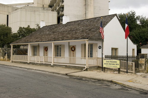
    Casa Navarro State Historic Site

    The restored home and property interpret the life of José Antonio Navarro, a Tejano statesman, signer of the Texas Declaration of Independence and influential early Texas leader. Casa Navarro adds an indispensable Tejano perspective to a San Antonio history itinerary that can otherwise lean too heavily on military sites alone.

    Best season: Year-round; spring and fall are usually the most comfortable for outdoor portions of a visit.Updated Aug 2026
    • Tejano history
    • José Antonio Navarro
    • San Antonio
    Explore this place

    Approx. 4 miles away

Around San Antonio

More near the closest town

Other destinations connected to San Antonio.

  • San Antonio · Bexar County · South Texas Plains

    San Antonio Aquarium

    An interactive northwest San Antonio attraction combining sharks, stingrays and marine life with animal encounters involving birds, reptiles and mammals.

    Best season: Year-round; it is primarily an indoor family attraction and works well as a heat or rain backup.Updated Aug 2026
    • Sharks and stingrays
    • Interactive animal encounters
    • Rainforest reptiles
    Explore this place

    Approx. 12 miles away

  • San Antonio · Bexar County · South Texas Plains

    San Antonio Zoo

    San Antonio Zoo includes the historic Friedrich Aquarium, an operating 1948 aquarium with both freshwater and saltwater animals inside the larger Brackenridge Park zoo.

    Best season: Fall through spring for comfortable outdoor walking; summer visits are best started early with indoor habitats used during peak heat.Updated Aug 2026
    • Friedrich Aquarium
    • Freshwater and saltwater animals
    • Africa Live aquatic habitats
    Explore this place

    Approx. 7 miles away

  • San Antonio · Comal County

    Natural Bridge Caverns

    A major Hill Country cave attraction north-east of San Antonio where guided routes descend through enormous limestone rooms, stalactites, stalagmites and flowstone, with multiple cavern experiences and above-ground family attractions surrounding the natural limestone bridge that gave the site its name.

    Best season: Year-round underground, where cavern temperatures stay comparatively stable; spring and fall are most comfortable for combining cave tours with above-ground attractionsUpdated Aug 2026
    • Discovery Tour through the original cavern rooms
    • Hidden Wonders tour and large underground chambers
    • Natural limestone bridge at the cavern entrance
    Explore this place

    Approx. 24 miles away

  • San Antonio · Comal County

    Natural Bridge Wildlife Ranch

    A 500-acre drive-through safari beside Natural Bridge Caverns where visitors travel in their own enclosed vehicles among more than 500 animals from dozens of species, then continue through walkable animal areas and optional guided safari experiences.

    Best season: Fall through spring for comfortable temperatures; the ranch recommends morning arrival for animal activity and lighter crowds, especially on weekends, holidays and summer daysUpdated Aug 2026
    • Self-guided drive-through safari across 500 acres
    • More than 500 animals representing roughly 40 species
    • Giraffes, antelope, bison and other free-ranging hoofstock
    Explore this place

    Approx. 25 miles away

  • San Antonio · Bexar County · South Texas Plains

    Fort Sam Houston National Cemetery

    The VA national cemetery in San Antonio is one of Texas' major military memorial landscapes and the burial place of generations of service members, including multiple Medal of Honor recipients. Use the cemetery to connect San Antonio's long military identity with individual veteran stories, memorial traditions and the modern National Cemetery Administration system.

    Best season: Open daily from sunrise to sunset. Spring and fall usually offer the most comfortable weather for walking the grounds.Updated Aug 2026
    • veterans
    • Medal of Honor
    • San Antonio military history
    Explore this place

    Approx. 8 miles away

  • San Antonio · Bexar County · South Texas Plains

    San Antonio Museum of Art

    San Antonio Museum of Art occupies the historic Lone Star Brewery complex on the Museum Reach of the River Walk, with global collections spanning ancient Mediterranean cultures, Asian art, Latin American art, European painting and contemporary work.

    Best season: Year-round indoor museum; fall through spring is especially pleasant for arriving by the River Walk's Museum Reach or combining the galleries with nearby outdoor stops.Updated Aug 2026
    • Global art collections
    • Historic Lone Star Brewery
    • Museum Reach of the River Walk
    Explore this place

    Approx. 5 miles away

Build a better day

Pair this stop with something different

Nearby parks, water, towns, history and outdoor places that complement this destination.

  • Castroville · Medina County

    Castroville

    Castroville is a Medina River town west of San Antonio where Alsatian settlement history, preserved nineteenth-century architecture, a large historic district, Landmark Inn and riverfront parks create one of Texas's most distinctive European-heritage small-town visits.

    Best season: Fall through spring for historic walking and riverfront trails; warm months for park and pool recreation with heat planningUpdated Sep 2026
    • Castroville Historic District
    • Alsatian heritage
    • Landmark Inn
    Explore this place

    Approx. 24 miles away

  • New Braunfels · Comal County

    New Braunfels

    A German-Texan Hill Country city built around the Comal and Guadalupe rivers, with tubing, historic neighborhoods, Gruene and strong access to Canyon Lake.

    Best season: Late spring through early fall for river recreation; fall through spring for town exploringUpdated Sep 2026
    • Comal River
    • Guadalupe River
    • Gruene Historic District
    Explore this place

    Approx. 32 miles away

  • Bandera · Bandera County

    Bandera

    A Medina River Hill Country town where cowboy heritage meets public river swimming, tubing and paddling, with music, horseback riding and access to rugged country west of San Antonio.

    Best season: Late spring through early fall for Medina River recreation; fall through spring for riding and town exploringUpdated Sep 2026
    • Medina River swimming and tubing
    • Bandera City Park river access
    • Cowboy and ranching heritage
    Explore this place

    Approx. 44 miles away

  • San Marcos · Hays County

    San Marcos

    A Central Texas city built around powerful artesian springs and the clear San Marcos River, with tubing, paddling, a walkable downtown and a major university presence.

    Best season: Year-round for spring-fed water; warm months are busiest for river recreationUpdated Sep 2026
    • San Marcos River tubing
    • City Park public river access
    • Spring Lake and The Meadows Center
    Explore this place

    Approx. 48 miles away

  • Comfort · Kendall County

    Comfort

    Comfort is a highly preserved German-Texan Hill Country community where more than a century of limestone architecture, walkable High Street, freethinker history, local shops and Guadalupe River country create a relaxed heritage weekend.

    Best season: Fall through spring for walking the historic district; spring for Hill Country scenery and comfortable outdoor timeUpdated Sep 2026
    • Comfort Historic District
    • High Street
    • German-Texan heritage
    Explore this place

    Approx. 49 miles away

  • Wimberley · Hays County

    Wimberley

    A small Hill Country town on Cypress Creek and the Blanco River, known for spring-fed swimming, galleries, markets, shaded roads and nearby natural areas.

    Best season: Spring through fall for water recreation; fall and winter are quieter for town walks and scenic drivesUpdated Sep 2026
    • Blue Hole Regional Park
    • Cypress Creek town center
    • Jacob's Well Natural Area
    Explore this place

    Approx. 50 miles away

Add some water

Nearby water stops

Lakes, rivers, springs and coastal places that can fit into the same trip.

  • Spring Branch · Comal County

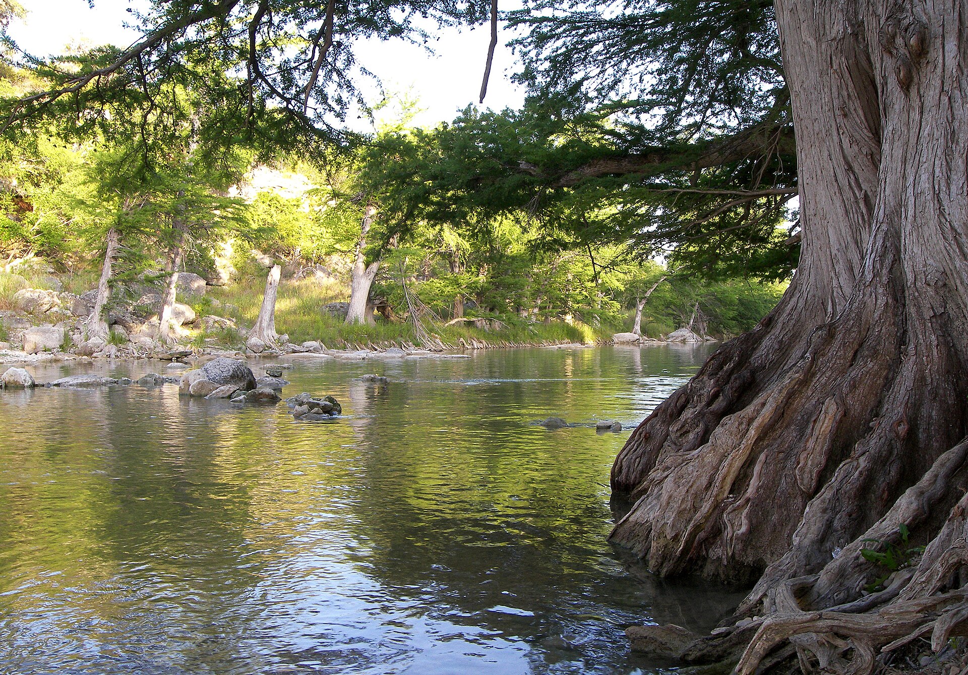
    Guadalupe River State Park

    Four miles of Guadalupe River frontage between San Antonio and the Hill Country, pairing cypress-lined swimming and paddling water with trails, camping and access to the protected Honey Creek landscape.

    Best season: Late spring through early fall for river time; fall through spring for comfortable hiking
    • Four miles of Guadalupe River frontage
    • Swimming, tubing, paddling and fishing when river conditions allow
    • Hill Country trails through prairie, oak woodland and river corridor
    Explore this place

    Approx. 34 miles away

  • Wimberley

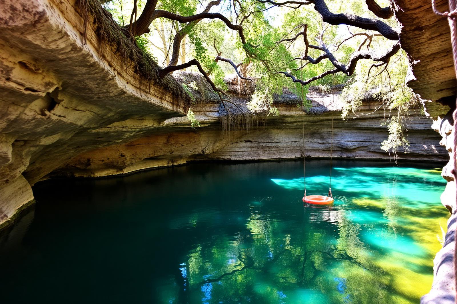
    Blue Hole, Wimberley

    A spring-fed swimming area on Cypress Creek inside Wimberley's Blue Hole Regional Park, shaded by mature cypress trees and managed through a seasonal reservation system that protects the experience from uncontrolled crowding.

    Best season: May through early September for reserved swimming; the surrounding regional park is open year-roundUpdated Aug 2026
    • Spring-fed Cypress Creek swimming beneath mature cypress trees
    • Reservation-controlled seasonal swim sessions
    • Shaded lawns and regional-park recreation outside the swim area
    Explore this place

    Approx. 50 miles away

  • Blanco · Blanco County

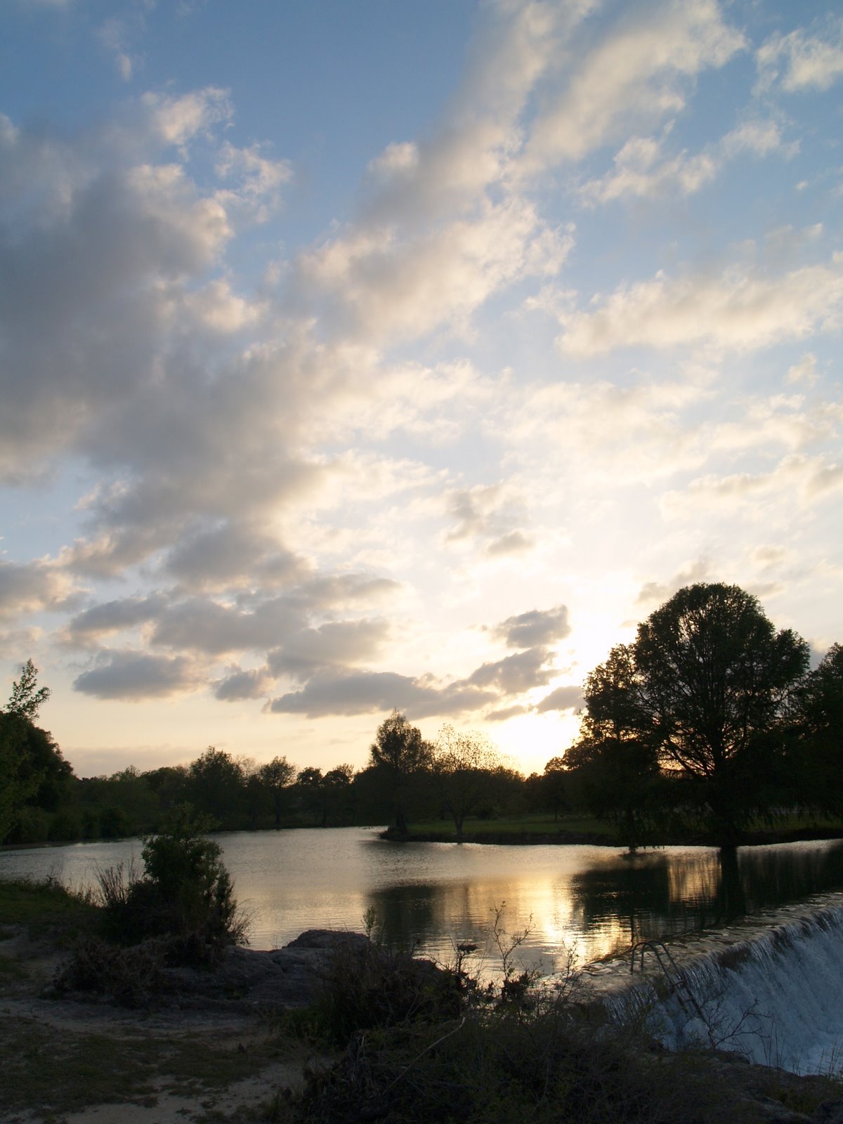
    Blanco State Park

    A small Hill Country park wrapped around a mile of the Blanco River, with limestone dams, swimming, fishing, paddling and shaded picnic areas within walking distance of downtown Blanco.

    Best season: Late spring through early fall for river time; fall and spring for picnics and fishing
    • Blanco River swimming and wading
    • Historic limestone river dams
    • Fishing and paddling
    Explore this place

    Approx. 51 miles away

  • Wimberley · Hays County

    Jacob's Well Natural Area

    A deep artesian spring and karst opening near Wimberley that forms the headwaters of Cypress Creek, protected within a Hays County natural area with trails and tightly managed water access.

    Best season: Fall through spring for trails; the natural area remains a hiking destination while swimming is closedUpdated Sep 2026
    • Artesian spring opening
    • Cypress Creek headwaters
    • Hill Country karst geology
    Explore this place

    Approx. 51 miles away

Add some Texas context

Historic stops nearby

Historic sites, small towns and road-trip stops that add context to the route.

  • San Antonio · Bexar County · South Texas Plains

    Spanish Governor's Palace

    The Spanish Governor's Palace is an eighteenth-century Spanish Colonial residence in downtown San Antonio and the last visible architectural trace of the Presidio San Antonio de Béxar complex.

    Best season: Year-round historic house; fall through spring is most comfortable for combining the interior rooms and courtyard with a longer downtown heritage walk.Updated Aug 2026
    • Spanish Colonial architecture
    • Presidio San Antonio de Béxar
    • Eighteenth-century rooms and courtyard
    Explore this place

    Approx. 5 miles away

  • San Antonio · Bexar County · South Texas Plains

    Artpace

    Artpace is a free contemporary art center in downtown San Antonio built around an internationally recognized artist-in-residence program, with rotating exhibitions of work created by Texas, national and international artists.

    Best season: Year-round indoor art destination; fall through spring is most comfortable for walking between Artpace, downtown plazas and nearby cultural stops.Updated Aug 2026
    • International Artist-in-Residence program
    • Free contemporary art exhibitions
    • Texas, national and international artists
    Explore this place

    Approx. 5 miles away

Keep the day outside

More outdoors nearby

Parks, caverns and outdoor destinations that pair naturally with this stop.

  • Gonzales · Gonzales County

    Palmetto State Park

    A small, lush park near Gonzales where dwarf palmettos, swampy lowlands, the San Marcos River and a CCC-built landscape create scenery that feels unexpectedly subtropical for Central Texas.

    Best season: Fall through spring for hiking; warm months for paddling with humidity precautions
    • Dwarf palmetto groves
    • San Marcos River paddling and fishing
    • CCC-built structures
    Explore this place

    Approx. 56 miles away

  • Lockhart · Caldwell County

    Lockhart State Park

    A small Central Texas state park beside Clear Fork Creek, notable for wooded trails, a historic CCC-built recreation landscape and the only golf course in the Texas State Park system.

    Best season: Fall through spring for hiking and golf; summer visits are best early or late in the day
    • Historic nine-hole state-park golf course
    • Civilian Conservation Corps structures
    • Short wooded and creekside trails
    Explore this place

    Approx. 58 miles away

  • Austin · Travis County

    Lady Bird Johnson Wildflower Center

    The University of Texas at Austin's native-plant botanical garden in South Austin, where designed gardens, prairie restoration, an arboretum, family garden and nature trails show how Texas wildflowers and native landscapes can be beautiful, resilient and ecologically useful year-round.

    Best season: Spring for wildflowers, fall for comfortable trails and native grasses, and year-round for designed native gardens; bloom timing always depends on weather rather than a fixed calendar dateUpdated Aug 2026
    • Texas native-plant gardens and ecological landscape design
    • Seasonal wildflower displays and bluebonnet areas
    • Texas Arboretum and walking trails
    Explore this place

    Approx. 68 miles away

More like this

People also visit

Similar destinations, favoring the same region and the shortest available distance.

  • Harlingen · Cameron County · South Texas Plains

    Iwo Jima Museum and Monument

    The monument and museum commemorate the Marines associated with the famous flag-raising on Mount Suribachi during the 1945 Battle of Iwo Jima. The site links the Rio Grande Valley to one of World War II's most recognizable images and to the military training history of South Texas.

    Best season: Year-round; spring and fall are usually the most comfortable for outdoor portions of a visit.Updated Aug 2026
    • World War II
    • U.S. Marines
    • Rio Grande Valley
    Explore this place

    Approx. 224 miles away

  • Castroville · Medina County · South Texas Plains

    Landmark Inn State Historic Site

    The 19th-century complex served travelers and residents as a tavern, store, hotel and mill along the Medina River. An overnight stay can turn a historic-site visit into part of the experience while introducing Castroville's distinctive Alsatian heritage.

    Best season: Year-round; spring and fall are usually the most comfortable for outdoor portions of a visit.Updated Aug 2026
    • historic lodging
    • Castroville
    • Alsatian Texas
    Explore this place

    Approx. 24 miles away

  • Brownsville · Cameron County · South Texas Plains

    Palmito Ranch Battlefield

    Palmito Ranch is associated with the final land battle of the American Civil War, fought near the Rio Grande in May 1865. The remote battlefield is best approached as a landscape-history stop that explains why fighting continued in Texas after major Confederate armies had surrendered elsewhere.

    Best season: Year-round; spring and fall are usually the most comfortable for outdoor portions of a visit.Updated Aug 2026
    • Civil War
    • battlefields
    • Rio Grande
    Explore this place

    Approx. 247 miles away

  • Brownsville · Cameron County · South Texas Plains

    Palo Alto Battlefield National Historical Park

    The preserved South Texas prairie where U.S. and Mexican armies fought the first major battle of the U.S.–Mexican War on May 8, 1846.

    Best season: November through May offers milder South Texas weather; check current park conditions before visiting.Updated Aug 2026
    • 1846 battlefield
    • Visitor center
    • Battlefield trails
    Explore this place

    Approx. 239 miles away

  • San Antonio · Bexar County · South Texas Plains

    McNay Art Museum

    The McNay Art Museum combines modern and contemporary art, works on paper, sculpture, theater arts and changing exhibitions with the Spanish Colonial Revival residence and landscaped grounds of Marion Koogler McNay's former estate.

    Best season: Year-round indoor museum; fall through spring is best for spending additional time on the 25-acre grounds and sculpture-filled campus.Updated Aug 2026
    • Modern and contemporary art
    • Spanish Colonial Revival mansion
    • 25-acre sculpture campus
    Explore this place

    Approx. 9 miles away

Keep exploring the region

More in this part of Texas

Additional places from the same Texas region.

  • South Padre Island · Cameron County · South Texas Plains

    Sea Turtle, Inc.

    South Padre Island’s sea-turtle rescue and education center lets visitors learn about rehabilitation, resident turtles and Gulf conservation beside the Laguna Madre.

    Best season: Year-round; summer connects naturally with a South Padre beach trip, while winter can be especially meaningful for understanding cold-stun rescue work.Updated Aug 2026
    • Sea-turtle rehabilitation
    • Resident turtles
    • Conservation education
    Explore this place

    Approx. 237 miles away

  • Corpus Christi · Nueces County · South Texas Plains

    Whitecap Beach

    A North Padre Island Gulf beach at the end of Whitecap Boulevard with both pedestrian-only shoreline and vehicle-access areas near the Corpus Christi beach corridor.

    Best season: October through May for milder weather; summer works for beach days with heat, storms and surf conditions checked closelyUpdated Sep 2026
    • Open-Gulf beach
    • Padre Island & South Texas setting
    • Corpus Christi access
    Explore this place

    Approx. 145 miles away

  • Corpus Christi · Nueces County · South Texas Plains

    Malaquite Beach

    The vehicle-free beach beside Malaquite Visitor Center in Padre Island National Seashore, offering a quieter developed access point with parking, restrooms and showers.

    Best season: October through May for milder weather; summer works for beach days with heat, storms and surf conditions checked closelyUpdated Sep 2026
    • National-seashore coastline
    • Padre Island & South Texas setting
    • Corpus Christi access
    Explore this place

    Approx. 151 miles away

  • Corpus Christi · Nueces County · South Texas Plains

    Padre Island National Seashore Backcountry / South Beach

    The long undeveloped South Beach and down-island Gulf shoreline of Padre Island National Seashore, where remote beach driving, primitive camping and exceptional barrier-island solitude replace developed amenities.

    Best season: October through May for milder weather; summer works for beach days with heat, storms and surf conditions checked closelyUpdated Sep 2026
    • National-seashore coastline
    • Padre Island & South Texas setting
    • Corpus Christi access
    Explore this place

    Approx. 152 miles away

  • Corpus Christi · Kleberg County · South Texas Plains

    Yarborough Pass

    A remote primitive camping and small-boat access area on the Laguna Madre side of Padre Island National Seashore, reached from South Beach by a high-clearance four-wheel-drive route.

    Best season: October through May for milder weather; summer works for beach days with heat, storms and surf conditions checked closelyUpdated Sep 2026
    • Coastal shoreline and habitat area
    • Padre Island & South Texas setting
    • Corpus Christi access
    Explore this place

    Approx. 163 miles away

  • South Padre Island · Cameron County · South Texas Plains

    South Padre Island Beaches

    The developed resort-city Gulf shoreline of South Padre Island, connected by city and county beach accesses and extending north toward drive-on county beach areas.

    Best season: October through May for milder weather; summer works for beach days with heat, storms and surf conditions checked closelyUpdated Sep 2026
    • Open-Gulf beach
    • Padre Island & South Texas setting
    • South Padre Island access
    Explore this place

    Approx. 238 miles away

Read next

More from Historic Sites & Museums