Skip to content
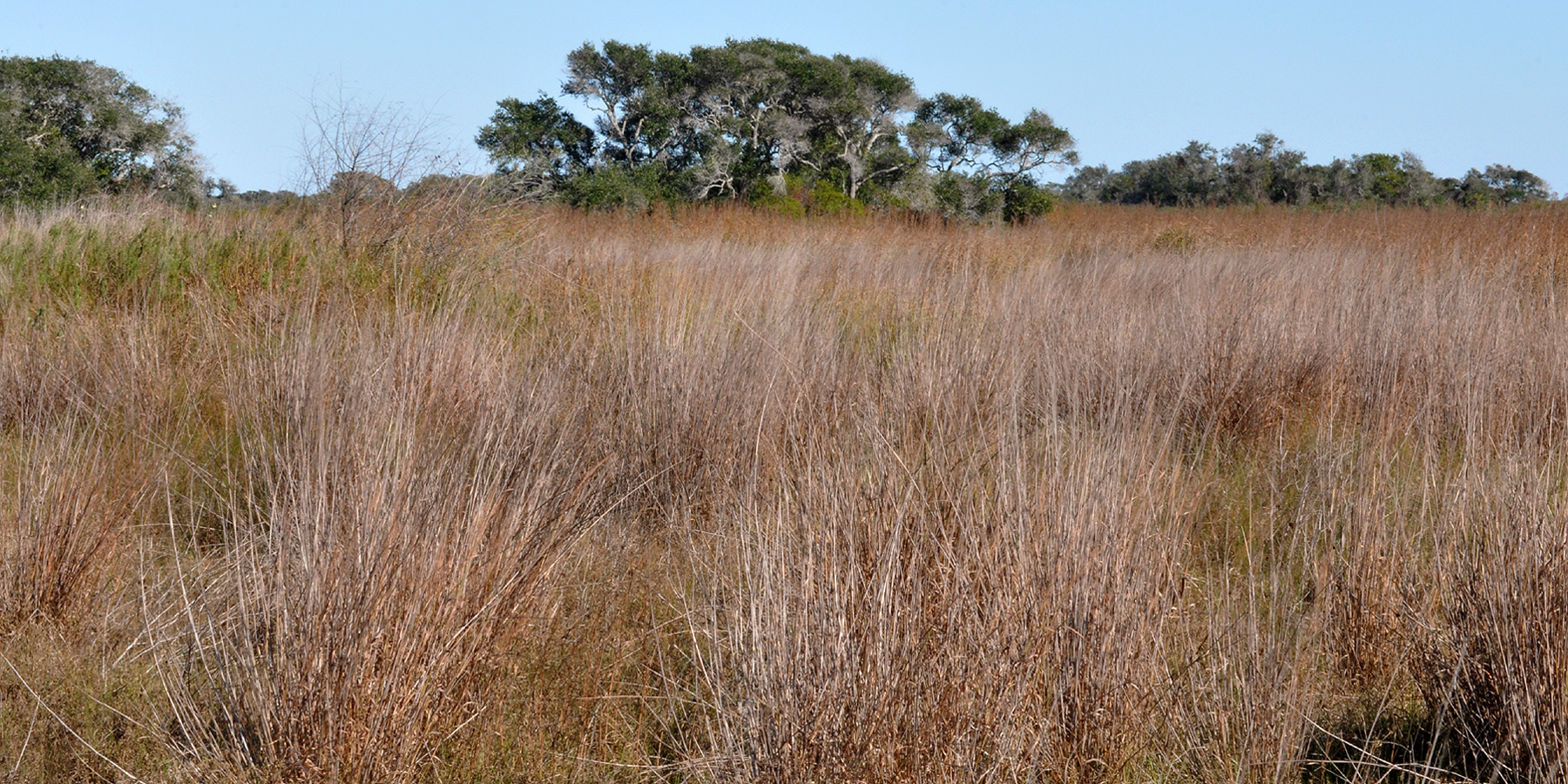
USGS National Map aerial orthoimagery centered on Yarborough Pass, Texas

South Texas Plains · Beaches & Coast

Yarborough Pass

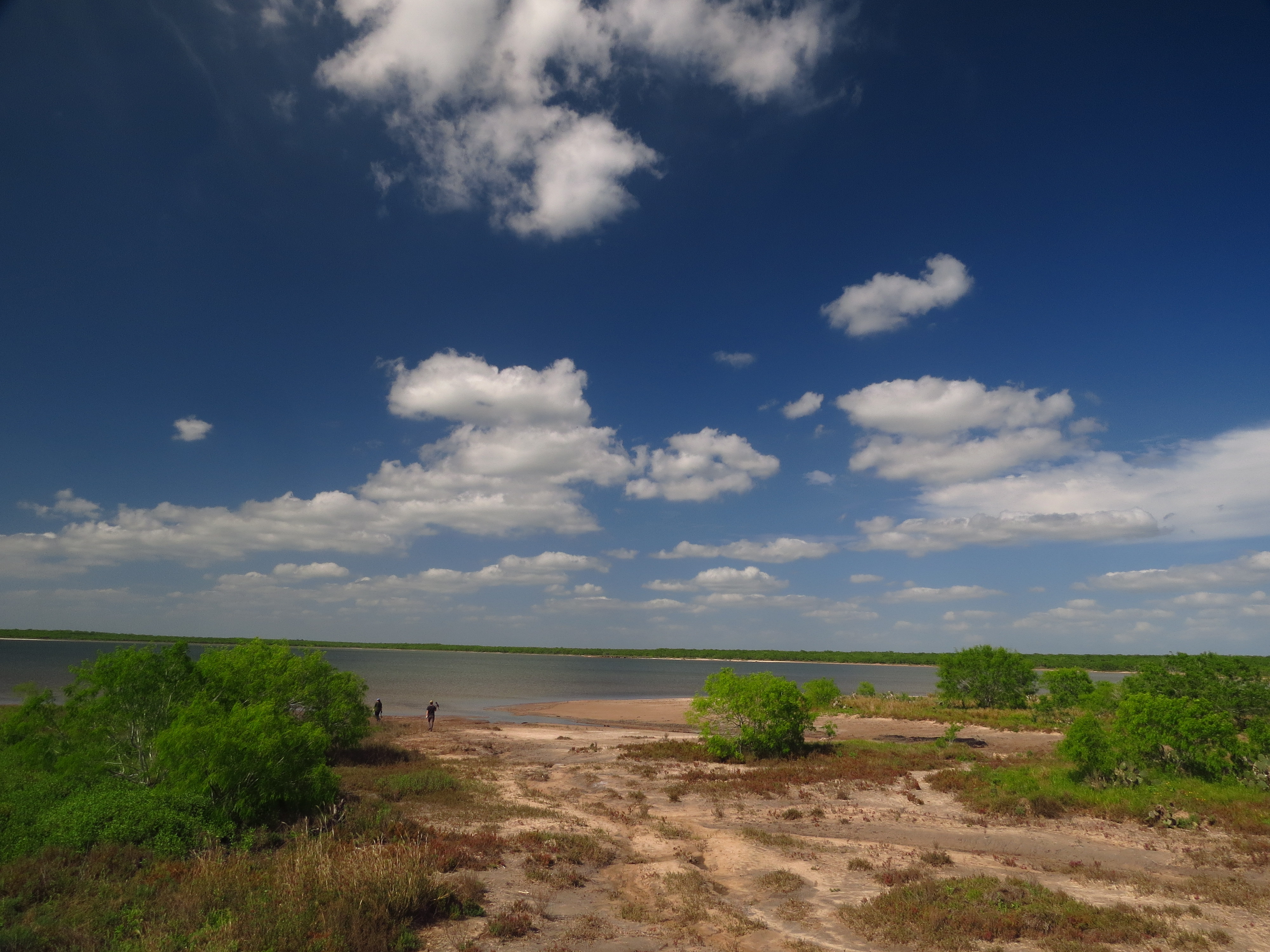
A remote primitive camping and small-boat access area on the Laguna Madre side of Padre Island National Seashore, reached from South Beach by a high-clearance four-wheel-drive route.

Photography: USDA / USGS The National Map orthoimagery · Public domain

Plan the visit

Yarborough Pass at a glance

Where is Yarborough Pass?
Yarborough Pass is near Corpus Christi, Texas, in Kleberg County.
When is the best time to visit Yarborough Pass?
October through May for milder weather; summer works for beach days with heat, storms and surf conditions checked closely
Do I need to plan ahead for Yarborough Pass?
High-clearance four-wheel drive is required and the route can close after heavy rain; visitors first drive about 15 miles down South Beach before crossing the island.
Who manages Yarborough Pass?
National Park Service

The place

Why Yarborough Pass belongs on the list

A remote primitive camping and small-boat access area on the Laguna Madre side of Padre Island National Seashore, reached from South Beach by a high-clearance four-wheel-drive route. TexasDefined treats Yarborough Pass specifically as a coastal shoreline and habitat area in the Padre Island & South Texas, rather than collapsing it into a generic list of Texas beaches. That distinction affects what visitors should expect from the water, facilities, access and the amount of preparation a trip requires.

High-clearance four-wheel drive is required and the route can close after heavy rain; visitors first drive about 15 miles down South Beach before crossing the island. Public access depends on current road, tide, construction, launch, weather or operational conditions, so a same-day check matters. Coastal conditions are unusually changeable: wind, tides, rip currents, sargassum, erosion, construction and storm recovery can alter a beach day even when the destination itself remains open. The managing source linked on this guide is therefore part of the trip plan, not just background reading.

Yarborough Pass is associated with Kleberg County and the nearest practical base is Corpus Christi. That location places it within a larger network of Gulf beaches, bay shorelines, barrier islands, wetlands and fishing communities, so it works best when readers understand whether they are choosing open surf, protected bay water, habitat exploration, beach driving or a managed park experience.

For a first visit, use the mapped point on this page as the representative public arrival or observation area, then follow posted signs and current agency guidance once on site. TexasDefined reviewed the destination source and coordinate evidence on 2026-09-06; the source date is shown so readers can distinguish researched planning guidance from timeless descriptive copy.

The details

Plan the visit

Nearest town
Near Corpus Christi, Texas
Best season
October through May for milder weather; summer works for beach days with heat, storms and surf conditions checked closely
Entry & reservations
High-clearance four-wheel drive is required and the route can close after heavy rain; visitors first drive about 15 miles down South Beach before crossing the island.

Tours & bookable experiences

Add an experience around Yarborough Pass

TexasDefined handles the destination planning. Viator can be useful for guided tours, tickets and organized activities near Corpus Christi. Availability changes, so the booking link checks current inventory rather than promising a specific product.

Affiliate disclosure: TexasDefined may earn a commission from qualifying Viator bookings, at no additional cost to you.

Quick answer

Planning a visit to Yarborough Pass

What is Yarborough Pass?
A remote primitive camping and small-boat access area on the Laguna Madre side of Padre Island National Seashore, reached from South Beach by a high-clearance four-wheel-drive route.
When is the best time to go?
October through May for milder weather; summer works for beach days with heat, storms and surf conditions checked closely
What should I know before arriving?
High-clearance four-wheel drive is required and the route can close after heavy rain; visitors first drive about 15 miles down South Beach before crossing the island.
Where is it?
Near Corpus Christi, Texas, in Kleberg County.

Field notes

What to know before you go

Conditions, closures, fees and availability can change. Use these notes to plan, then confirm the latest details with the official site before making the drive.

Don’t miss

  • Coastal shoreline and habitat area
  • Padre Island & South Texas setting
  • Corpus Christi access
  • Conditions-dependent access

Good to know

  • Best time to go: October through May for milder weather; summer works for beach days with heat, storms and surf conditions checked closely.
  • High-clearance four-wheel drive is required and the route can close after heavy rain; visitors first drive about 15 miles down South Beach before crossing the island.

Build the trip

Places that pair well with this stop

Nearby places, worthwhile detours and combinations for adding water, history, outdoors or a full weekend around this destination.

Close enough for the same trip

Nearby places

Places ordered by straight-line distance when reliable coordinates are available.

  • Corpus Christi · Nueces County · South Texas Plains

    Padre Island National Seashore Backcountry / South Beach

    The long undeveloped South Beach and down-island Gulf shoreline of Padre Island National Seashore, where remote beach driving, primitive camping and exceptional barrier-island solitude replace developed amenities.

    Best season: October through May for milder weather; summer works for beach days with heat, storms and surf conditions checked closelyUpdated Sep 2026
    • National-seashore coastline
    • Padre Island & South Texas setting
    • Corpus Christi access
    Explore this place

    Approx. 16 miles away

  • Corpus Christi · Nueces County

    Padre Island National Seashore

    A long protected barrier-island coastline south of Corpus Christi where undeveloped Gulf beaches, dunes, tidal flats, sea-turtle conservation, bird migration and miles of beach driving preserve a much wilder Texas coast than the resort districts nearby.

    Best season: Fall through spring for mild beach weather and birding; summer brings heat, humidity and storm risk but also seasonal sea-turtle activity, so conditions should guide every visitUpdated Aug 2026
    • Malaquite Beach and Visitor Center
    • Miles of undeveloped Gulf shoreline and dunes
    • Seasonal Kemp's ridley sea-turtle conservation programs
    Explore this place

    Approx. 16 miles away

  • Corpus Christi · Nueces County · South Texas Plains

    Malaquite Beach

    The vehicle-free beach beside Malaquite Visitor Center in Padre Island National Seashore, offering a quieter developed access point with parking, restrooms and showers.

    Best season: October through May for milder weather; summer works for beach days with heat, storms and surf conditions checked closelyUpdated Sep 2026
    • National-seashore coastline
    • Padre Island & South Texas setting
    • Corpus Christi access
    Explore this place

    Approx. 18 miles away

  • Corpus Christi · Nueces County · South Texas Plains

    Whitecap Beach

    A North Padre Island Gulf beach at the end of Whitecap Boulevard with both pedestrian-only shoreline and vehicle-access areas near the Corpus Christi beach corridor.

    Best season: October through May for milder weather; summer works for beach days with heat, storms and surf conditions checked closelyUpdated Sep 2026
    • Open-Gulf beach
    • Padre Island & South Texas setting
    • Corpus Christi access
    Explore this place

    Approx. 29 miles away

  • Corpus Christi · Nueces County

    Oso Bay Coast & Wetlands Preserve

    The shallow Oso Bay shoreline and wetland system on Corpus Christi's south side, important for habitat, birding, nature education and paddling rather than conventional beach swimming.

    Best season: Fall through spring for comfortable exploring and birding; summer requires more heat, storm and insect planningUpdated Sep 2026
    • Coastal shoreline and habitat area
    • Mustang Island & Corpus Christi Bay setting
    • Corpus Christi access
    Explore this place

    Approx. 32 miles away

  • Corpus Christi · Nueces County

    Cole Park Beach

    The Corpus Christi Bay waterfront at Cole Park, best understood as a major city park and bayfront promenade with shoreline access rather than a formal open-Gulf beach.

    Best season: Fall through spring for comfortable exploring and birding; summer requires more heat, storm and insect planningUpdated Sep 2026
    • Coastal shoreline and habitat area
    • Mustang Island & Corpus Christi Bay setting
    • Corpus Christi access
    Explore this place

    Approx. 39 miles away

Around Corpus Christi

More near the closest town

Other destinations connected to Corpus Christi.

  • Corpus Christi · Nueces County

    Texas State Aquarium

    Corpus Christi’s waterfront aquarium combines Gulf and Caribbean marine life, wildlife presentations, conservation education and a major coastal visitor experience beside North Beach.

    Best season: Year-round; summer pairs naturally with a Corpus Christi beach trip, while cooler months make North Beach easier to combine with outdoor stops.Updated Aug 2026
    • Gulf and Caribbean marine life
    • Dolphin and wildlife presentations
    • Conservation and education
    Explore this place

    Approx. 42 miles away

  • Corpus Christi · Nueces County

    McGee Beach

    A downtown Corpus Christi Bay beach on Shoreline Boulevard within walking distance of the marina, hotels, museums and convention-center district.

    Best season: March through May and September through November for milder beach weather; summer is busiest and hottestUpdated Sep 2026
    • Protected-bay beach
    • Mustang Island & Corpus Christi Bay setting
    • Corpus Christi access
    Explore this place

    Approx. 40 miles away

  • Corpus Christi · Nueces County

    USS Lexington Museum

    The World War II Essex-class aircraft carrier USS Lexington (CV-16), preserved on Corpus Christi's North Beach as a National Historic Landmark and aviation museum.

    Best season: Year-round. Summer offers longer museum hours but the flight deck can be hot; cooler fall through spring weather is usually more comfortable for outdoor decks.Updated Aug 2026
    • World War II aircraft carrier
    • Flight deck
    • Naval aviation
    Explore this place

    Approx. 42 miles away

Build a better day

Pair this stop with something different

Nearby parks, water, towns, history and outdoor places that complement this destination.

  • Rockport · Aransas County

    Rockport

    A small central-coast town on Aransas Bay with art, fishing, birding and a working waterfront, well positioned for Goose Island State Park and winter whooping-crane trips.

    Best season: Fall through spring for birding and mild weather; summer for coastal recreationUpdated Sep 2026
    • Aransas Bay
    • Rockport Center for the Arts
    • Fishing and birding
    Explore this place

    Approx. 60 miles away

  • Fulton · Aransas County

    Fulton Mansion State Historic Site

    The elaborate 1870s mansion overlooking Aransas Bay reflects the wealth, technology and ambitions of George and Harriet Fulton. It is an architectural centerpiece for a Rockport-Fulton trip and a window into affluent Gulf Coast life after the Civil War.

    Best season: Year-round; spring and fall are usually the most comfortable for outdoor portions of a visit.Updated Aug 2026
    • Victorian architecture
    • Gulf Coast history
    • 19th-century technology
    Explore this place

    Approx. 63 miles away

  • Los Fresnos · Cameron County · South Texas Plains

    Laguna Atascosa National Wildlife Refuge

    A Lower Rio Grande Valley refuge protecting thornscrub, coastal prairie, wetlands and Laguna Madre habitat used by ocelots, aplomado falcons and hundreds of bird species.

    Best season: Fall through spring for birding and comfortable wildlife viewingUpdated Sep 2026
    • Ocelot conservation habitat
    • Exceptional Lower Valley birding
    • Coastal prairie and thornscrub
    Explore this place

    Approx. 67 miles away

  • Harlingen · Cameron County · South Texas Plains

    Iwo Jima Museum and Monument

    The monument and museum commemorate the Marines associated with the famous flag-raising on Mount Suribachi during the 1945 Battle of Iwo Jima. The site links the Rio Grande Valley to one of World War II's most recognizable images and to the military training history of South Texas.

    Best season: Year-round; spring and fall are usually the most comfortable for outdoor portions of a visit.Updated Aug 2026
    • World War II
    • U.S. Marines
    • Rio Grande Valley
    Explore this place

    Approx. 73 miles away

  • Port Isabel · Cameron County

    Port Isabel Lighthouse State Historic Site

    Texas' only lighthouse open to the public, an 1852 brick tower in Port Isabel where 75 winding stairs and short ladders lead to coastal views toward South Padre Island and a restored third-order Fresnel lens.

    Best season: Fall through spring for mild coastal weather; summer offers extended hours but greater heat and storm riskUpdated Aug 2026
    • Climb Texas' only publicly accessible lighthouse
    • Third-order Fresnel lens illuminated again since 2022
    • Views toward South Padre Island and Laguna Madre
    Explore this place

    Approx. 79 miles away

Add some Texas context

Historic stops nearby

Historic sites, small towns and road-trip stops that add context to the route.

  • Brownsville · Cameron County · South Texas Plains

    Palo Alto Battlefield National Historical Park

    The preserved South Texas prairie where U.S. and Mexican armies fought the first major battle of the U.S.–Mexican War on May 8, 1846.

    Best season: November through May offers milder South Texas weather; check current park conditions before visiting.Updated Aug 2026
    • 1846 battlefield
    • Visitor center
    • Battlefield trails
    Explore this place

    Approx. 82 miles away

Keep the day outside

More outdoors nearby

Parks, caverns and outdoor destinations that pair naturally with this stop.

  • Austwell · Aransas and Refugio counties County

    Aransas National Wildlife Refuge

    A vast coastal refuge north of Rockport protecting marsh, oak woodland and tidal flats best known as the principal wintering ground of the endangered whooping crane.

    Best season: November through March for whooping cranes; spring and fall for migrationUpdated Sep 2026
    • Wintering whooping cranes
    • Coastal marsh and tidal flats
    • Birding and wildlife drives
    Explore this place

    Approx. 85 miles away

  • Alamo · Cameron, Hidalgo, Starr and Willacy counties County · South Texas Plains

    Lower Rio Grande Valley National Wildlife Refuge

    Lower Rio Grande Valley National Wildlife Refuge protects a distributed wildlife corridor across deep South Texas, reconnecting thornscrub, resaca, river and brush habitats used by migratory birds and rare borderland species.

    Best season: Fall through spring for cooler temperatures, migration and peak birding activity.Updated Sep 2026
    • Lower Rio Grande wildlife corridor
    • Nearly 40,000 acres of public-use lands
    • Birding and wildlife photography
    Explore this place

    Approx. 90 miles away

  • Mission · Hidalgo County · South Texas Plains

    Bentsen-Rio Grande Valley State Park

    A flagship Lower Rio Grande Valley birding park near Mission, protecting subtropical resaca and thornscrub habitat where tropical species reach the northern edge of their range.

    Best season: Fall through spring for peak bird diversity and comfortable weatherUpdated Aug 2026
    • World Birding Center headquarters
    • About 360 recorded bird species
    • Hawk Observation Tower and migration viewing
    Explore this place

    Approx. 93 miles away

  • Wadsworth · Matagorda County

    Big Boggy National Wildlife Refuge

    Big Boggy National Wildlife Refuge protects coastal marsh and bay habitat near Matagorda Bay, with public use focused on wildlife-dependent recreation and seasonal waterfowl hunting in a remote Texas Mid-Coast setting.

    Best season: Fall through early spring for waterfowl, migratory birds and cooler coastal conditions.Updated Sep 2026
    • Matagorda Bay coastal marsh
    • Migratory waterfowl habitat
    • Remote wildlife observation
    Explore this place

    Approx. 149 miles away

Make a weekend of it

Build a full weekend

A mix of towns, food, history, parks and water that can turn one stop into a fuller itinerary.

  • Brownsville · Cameron County · South Texas Plains

    Palmito Ranch Battlefield

    Palmito Ranch is associated with the final land battle of the American Civil War, fought near the Rio Grande in May 1865. The remote battlefield is best approached as a landscape-history stop that explains why fighting continued in Texas after major Confederate armies had surrendered elsewhere.

    Best season: Year-round; spring and fall are usually the most comfortable for outdoor portions of a visit.Updated Aug 2026
    • Civil War
    • battlefields
    • Rio Grande
    Explore this place

    Approx. 87 miles away

  • Goliad · Goliad County

    Presidio La Bahía

    A restored Spanish colonial presidio in Goliad associated with the Texas Revolution and the Goliad Massacre, with a chapel, museum and fortified courtyard overlooking the San Antonio River valley.

    Best season: Fall through spring for comfortable historic-site touringUpdated Aug 2026
    • Spanish colonial presidio
    • Our Lady of Loreto Chapel
    • Goliad Campaign history
    Explore this place

    Approx. 100 miles away

More like this

People also visit

Similar destinations, favoring the same region and the shortest available distance.

  • South Padre Island · Cameron County · South Texas Plains

    Sea Turtle, Inc.

    South Padre Island’s sea-turtle rescue and education center lets visitors learn about rehabilitation, resident turtles and Gulf conservation beside the Laguna Madre.

    Best season: Year-round; summer connects naturally with a South Padre beach trip, while winter can be especially meaningful for understanding cold-stun rescue work.Updated Aug 2026
    • Sea-turtle rehabilitation
    • Resident turtles
    • Conservation education
    Explore this place

    Approx. 75 miles away

  • South Padre Island · Cameron County · South Texas Plains

    South Padre Island Beaches

    The developed resort-city Gulf shoreline of South Padre Island, connected by city and county beach accesses and extending north toward drive-on county beach areas.

    Best season: October through May for milder weather; summer works for beach days with heat, storms and surf conditions checked closelyUpdated Sep 2026
    • Open-Gulf beach
    • Padre Island & South Texas setting
    • South Padre Island access
    Explore this place

    Approx. 77 miles away

  • South Padre Island · Cameron County · South Texas Plains

    Isla Blanca Park

    Cameron County's major coastal park at the southern end of South Padre Island, with more than a mile of Gulf beach, pavilions, jetties, marina access, RV facilities and seasonal beach services.

    Best season: October through May for milder weather; summer works for beach days with heat, storms and surf conditions checked closelyUpdated Sep 2026
    • Managed coastal park
    • Padre Island & South Texas setting
    • South Padre Island access
    Explore this place

    Approx. 79 miles away

  • South Padre Island · Cameron County · South Texas Plains

    Andy Bowie County Park

    A Cameron County Gulf beach park just north of South Padre Island's developed core, with beach access, parking, pavilions, restrooms and RV facilities.

    Best season: October through May for milder weather; summer works for beach days with heat, storms and surf conditions checked closelyUpdated Sep 2026
    • Managed coastal park
    • Padre Island & South Texas setting
    • South Padre Island access
    Explore this place

    Approx. 75 miles away

  • South Padre Island · Cameron County · South Texas Plains

    E.K. Atwood Park

    A Cameron County beach access north of town that connects State Park Road 100 to Gulf shoreline and the island's vehicle-access beach corridor.

    Best season: October through May for milder weather; summer works for beach days with heat, storms and surf conditions checked closelyUpdated Sep 2026
    • Named public beach-access point
    • Padre Island & South Texas setting
    • South Padre Island access
    Explore this place

    Approx. 73 miles away

Keep exploring the region

More in this part of Texas

Additional places from the same Texas region.

  • San Antonio · Bexar County · South Texas Plains

    SEA LIFE San Antonio Aquarium

    A downtown San Antonio aquarium at the Shops at Rivercenter with an ocean tunnel, sharks, rescued sea turtles, stingrays, seahorses, jellyfish and a touchpool.

    Best season: Year-round; the indoor setting works well in summer heat and can be folded into a downtown River Walk and Alamo day.Updated Aug 2026
    • Ocean tunnel
    • Sharks and rescued sea turtles
    • Stingray Bay
    Explore this place

    Approx. 167 miles away

  • San Antonio · Bexar County · South Texas Plains

    San Antonio Aquarium

    An interactive northwest San Antonio attraction combining sharks, stingrays and marine life with animal encounters involving birds, reptiles and mammals.

    Best season: Year-round; it is primarily an indoor family attraction and works well as a heat or rain backup.Updated Aug 2026
    • Sharks and stingrays
    • Interactive animal encounters
    • Rainforest reptiles
    Explore this place

    Approx. 174 miles away

  • San Antonio · Bexar County · South Texas Plains

    San Antonio Zoo

    San Antonio Zoo includes the historic Friedrich Aquarium, an operating 1948 aquarium with both freshwater and saltwater animals inside the larger Brackenridge Park zoo.

    Best season: Fall through spring for comfortable outdoor walking; summer visits are best started early with indoor habitats used during peak heat.Updated Aug 2026
    • Friedrich Aquarium
    • Freshwater and saltwater animals
    • Africa Live aquatic habitats
    Explore this place

    Approx. 169 miles away

  • San Antonio · Bexar County · South Texas Plains

    The Alamo

    San Antonio's best-known historic landmark: the former Mission San Antonio de Valero, where more than three centuries of mission, military, revolutionary and preservation history converge in the heart of downtown.

    Best season: Fall through spring for comfortable downtown walking; in summer, visit near opening for cooler temperatures and lighter crowdsUpdated Aug 2026
    • Historic Alamo Church and Long Barrack
    • Alamo Exhibit and the Ralston Family Collections Center
    • Living History demonstrations and interpretation of the mission and 1836 battle
    Explore this place

    Approx. 167 miles away

  • San Antonio · Bexar County · South Texas Plains

    San Antonio River Walk

    San Antonio's 15-mile river corridor links the famous below-street downtown promenade with the Museum Reach, Pearl and the Mission Reach, combining cypress-shaded walks, restaurants, public art, river cruises and some of the city's most important historic places.

    Best season: Fall through spring for the most comfortable walking weather; summer is best early in the morning or after sunset, while the holiday season brings some of the River Walk's most recognizable evening lightsUpdated Aug 2026
    • The classic below-street downtown river loop with cypress trees, stone bridges, restaurants and river cruises
    • Museum Reach trail and public art extending north toward Pearl
    • Mission Reach trails connecting the river corridor with San Antonio's Spanish colonial mission landscape
    Explore this place

    Approx. 167 miles away

  • San Antonio · Bexar County · South Texas Plains

    San Antonio Missions National Historical Park

    Four Spanish colonial mission communities south of downtown San Antonio—Concepción, San José, San Juan and Espada—preserved along the San Antonio River as living parish, architectural and cultural landscapes connected to the city's UNESCO World Heritage story.

    Best season: Fall through spring for comfortable walking and biking; summer visits are best early in the day with shade and water built into the routeUpdated Aug 2026
    • Mission San José and the park's main visitor center
    • Mission Concepción's preserved church and stone architecture
    • Mission San Juan and the agricultural landscape
    Explore this place

    Approx. 163 miles away

Read next

More from Beaches & Coast

Beaches & Coast

How to Pick the Right Texas Beach

The Texas coast is not one beach repeated for 367 miles. Barrier islands, fishing towns and bays each reward a different kind of weekend.

August 7, 2026 · About 4 minutes