Texas Explained
Major Rivers of Texas: Basins, Regions & Waterways Explained
Quick answer
The short version
A practical guide to the major rivers and river basins of Texas, from the Rio Grande, Brazos and Colorado to the Guadalupe, Trinity, Sabine and East Texas systems — and how mountains, plains, aquifers and reservoirs shape where the water flows.
Read the full guide ↓You can understand a surprising amount of Texas by following the water. Towns grew where rivers could be crossed. Farms spread across bottomlands where floods left deep soil. Railroads, highways and county seats followed older settlement patterns. Modern cities now depend on reservoirs built into the same river systems, while summer weekends still revolve around stretches of water Texans have floated, fished and swum for generations.
The rivers do not all behave alike. A clear Hill Country stream flowing over limestone has little in common visually with a muddy Brazos bend, a cypress-lined East Texas river or the Rio Grande moving through desert canyons. That difference is the point. Texas is large enough that its rivers act like a second map of the state, revealing rainfall, geology, elevation and climate as they change from west to east.
Major Texas rivers by region and basin
Texas's best-known rivers belong to several very different geographic systems. The Rio Grande and Pecos cross arid mountain and desert country in the west. The Brazos and Colorado drain broad sections of West and Central Texas before reaching the Gulf. The Guadalupe, Nueces and San Antonio systems are strongly shaped by the Edwards Plateau, limestone and springs. The Trinity links North Texas to the coast, while the Sabine and Neches carry the wetter, forested character of East Texas. The Red and Canadian connect parts of northern Texas to larger river systems beyond the state.
- West Texas and the mountains: Rio Grande, Pecos and Devils River systems move through high desert, basins and canyon country.
- Central Texas and the plains: Brazos and Colorado systems cross large portions of the state and feed major reservoirs.
- Hill Country and South-Central Texas: Guadalupe, San Marcos, Comal, Frio, Nueces and San Antonio waterways reflect limestone geology and spring flow.
- North Texas: the Trinity drains the Dallas-Fort Worth region toward Trinity Bay, while the Red River forms much of the Texas-Oklahoma boundary.
- East Texas: Sabine and Neches systems run through the wetter Piney Woods toward Sabine Lake and the Gulf Coast.
Start with the basin, not just the river
A river makes more sense when you think about everything that drains toward it. That entire drainage area is its basin or watershed. Rain that falls on a pasture, neighborhood, canyon wall or city street eventually either soaks into the ground, evaporates or begins moving downhill through creeks and tributaries toward a larger river system.
The Texas Water Development Board recognizes 15 major river basins and eight coastal basins. The coastal basins occupy the areas between the larger named river systems and drain directly toward bays and the Gulf. On a map, those basin boundaries create a set of broad natural districts that ignore county lines and city limits.
That is useful because water does the same thing. A fast-growing suburb can affect a creek that crosses several counties. A reservoir hundreds of miles upstream can influence flows downstream. Heavy rain in one part of a basin can produce flooding somewhere that never saw the storm.
“Texas rivers are not blue lines laid on top of the state. They are systems that help explain the state itself.”
The Rio Grande: border river, desert river and international river
No Texas river carries more geographic meaning than the Rio Grande. It enters Texas at El Paso after beginning in Colorado and crossing New Mexico, then forms the international boundary between the United States and Mexico all the way to the Gulf. Along the way it passes through some of the driest country in the state, receives the Pecos and Devils rivers on the Texas side and supports communities whose histories are much older than the modern border.
The Rio Grande basin covers more area in Texas than any other major river basin, yet much of that territory is arid or semiarid. That creates the river's defining tension: enormous geography does not automatically mean abundant water. Irrigation, municipal demand, international agreements, reservoirs and drought all shape how much water actually moves through different reaches.
For travelers, the river changes personality repeatedly. Near Big Bend it can sit far below canyon walls and desert mesas. At Amistad, the river system becomes part of a vast reservoir landscape. Farther downstream, it is tied to farms, cities and the cultural geography of the Rio Grande Valley.
The Brazos: a river through the middle of Texas history
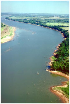
The Brazos begins as a named river where its Salt and Double Mountain forks meet in West Texas and then works southeast across the state to the Gulf. Its basin reaches from drier plains through the heart of Central Texas and into the humid coastal plain, giving the river a long cross-section of Texas geography.
Its name is tied to the Spanish phrase Brazos de Dios, or Arms of God, and the river appears again and again in the state's settlement story. Washington-on-the-Brazos sits beside it. Plantations and farms developed in its lower bottomlands. Communities used ferries and crossings long before bridges made the river easier to ignore from a car.
Today the Brazos is also a working water system. Tributaries such as the Leon, Little, Navasota and Paluxy connect large parts of the state to it, while reservoirs throughout the basin support cities, agriculture, industry, flood management and recreation. The river can look almost pastoral in one county and broad, brown and powerful in another.
The Colorado: the Texas river, not the Grand Canyon river
Texas has its own Colorado River, entirely separate from the better-known Colorado that carved the Grand Canyon. The Texas Colorado begins in West Texas and crosses the state toward Matagorda Bay. Along the way it gathers tributaries including the Concho, San Saba, Llano and Pedernales.
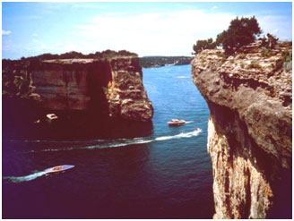
This is the river system behind some of Central Texas's most familiar water geography. The Highland Lakes are reservoirs on the Colorado, including Lake Buchanan, Inks Lake, Lake LBJ, Lake Marble Falls, Lake Travis and Lake Austin. Lady Bird Lake is also a reservoir on the river through Austin. What many people experience as a chain of separate lakes is really one managed river system.
Upstream, the Colorado moves through much drier country. Downstream, the landscape becomes greener and flatter before the river reaches the Gulf. That long transition helps explain why the same river can be associated with West Texas water supply, Hill Country recreation, Austin's urban landscape and coastal agriculture.
The Guadalupe: the river most Texans learn by getting in it
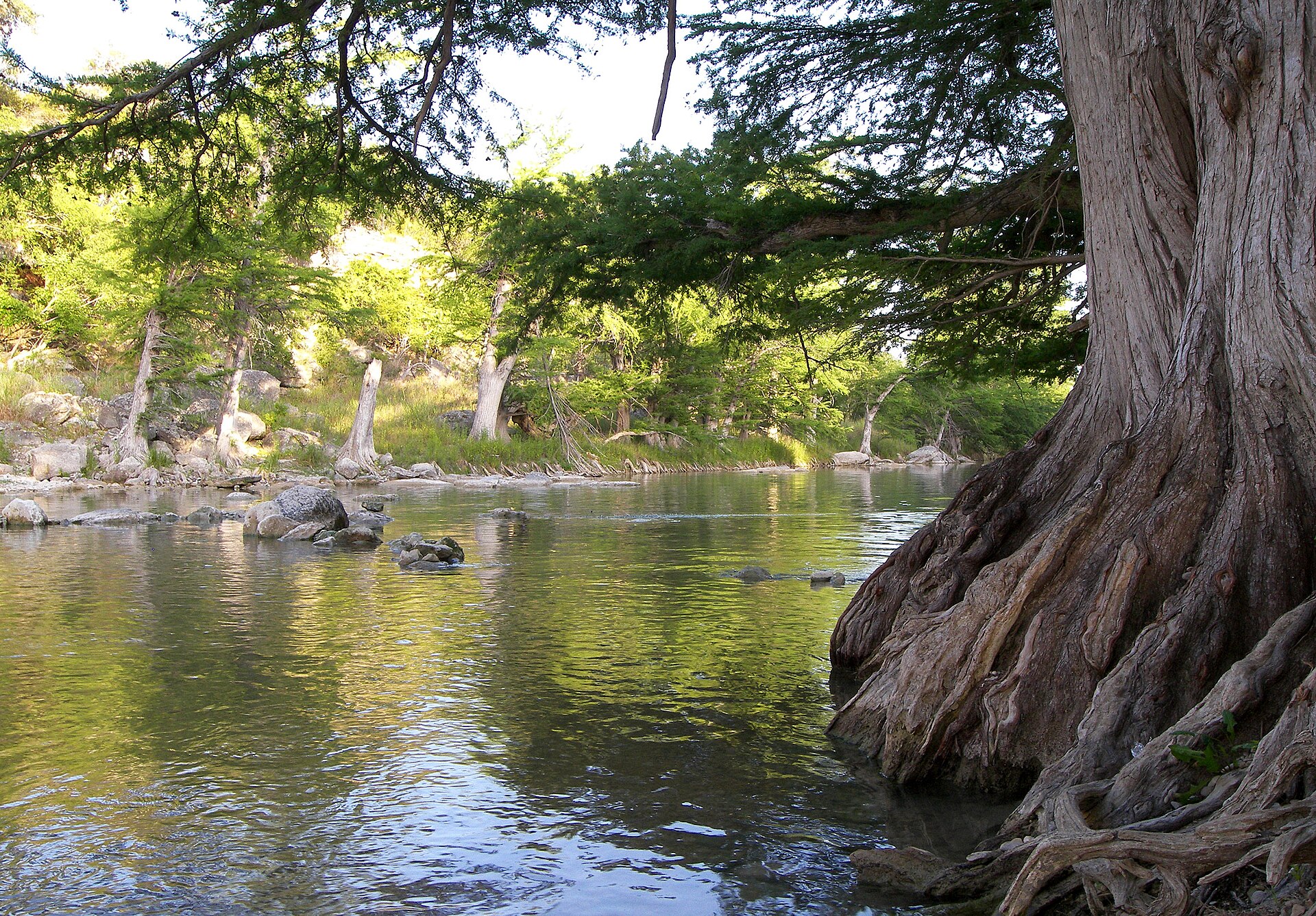
The Guadalupe begins where its North and South forks meet in Kerr County and flows southeast toward San Antonio Bay. In between, it passes through one of the state's most recognizable river landscapes: limestone, bald cypress, clear water, low bluffs and towns whose summer identity is inseparable from the river.
The basin also includes the Blanco, Comal and San Marcos rivers. Those tributaries show why surface water and groundwater cannot always be treated as separate stories in Central Texas. Springs and aquifers help sustain river flows, and changes underground can show up as changes in swimming holes, spring runs and downstream habitat.
Canyon Lake is the basin's major reservoir and adds flood control, water supply and recreation to a river already famous for tubing, paddling and fishing. The result is a river that feels natural and heavily managed at the same time, because it is both.
The Nueces and Frio: clear water in dry country
The Nueces rises in the Edwards Plateau country of Real and Edwards counties and runs toward Nueces Bay on the Gulf Coast. Its basin includes the Frio, Sabinal, Leona and Atascosa rivers. For many Texans, the Frio is the most familiar part of the system because of Garner State Park, tubing and the cypress-lined reaches around Concan.
The surprise is how dry the larger basin can be. Clear pools and spring-fed reaches can create an impression of permanent abundance, but the Nueces basin is relatively arid and drought can dramatically change flows. Choke Canyon Reservoir and Lake Corpus Christi help turn the river system into a major water source for the Coastal Bend.
The San Antonio: a city river with a much longer life
The San Antonio River begins at spring-fed headwaters in Bexar County, flows through the city and then continues southeast until it joins the Guadalupe near the coast. The famous downtown River Walk is therefore only one highly engineered reach of a much larger natural system.
Downstream, the river passes the San Antonio Missions and then moves into agricultural and coastal-plain country. The Medina River and Cibolo Creek are among the basin's important tributaries. Following the San Antonio from its headwaters southward is one of the clearest ways to see how a river can be simultaneously an ecological system, a civic landscape, a historic corridor and a source of water.
The Trinity: North Texas water headed for the coast
The Trinity River basin is the largest major river basin whose watershed lies entirely within Texas. The river forms from forks associated with North Texas, then flows south toward Trinity Bay. The upper basin contains the Dallas-Fort Worth region, making this one of the most urbanized river systems in the state.
That urban connection is easy to miss because much of the Trinity does not look like the kind of river Texans build vacations around. Yet it is fundamental to water supply and flood management for millions of people. Water from the basin also helps serve the Houston area, which means the Trinity's importance extends well beyond the places immediately beside its banks.
The Sabine and Neches: East Texas runs wetter
Drive far enough east and Texas rivers begin to feel different. Rainfall increases, forests close in and waterways carry more of the visual character associated with the lower South. The Sabine rises in Northeast Texas, forms much of the Texas-Louisiana border and eventually reaches Sabine Lake near the Gulf. Its basin receives high rainfall compared with much of the state and carries one of Texas's largest average river flows.
The Neches also belongs to the Piney Woods. It begins in East Texas and flows south to Sabine Lake, joined by the Angelina River and numerous bayous and creeks. Sam Rayburn Reservoir, built on the Angelina, is part of the Neches system. Farther downstream, broad bottomlands, sloughs and wet forests make the river feel worlds away from limestone Central Texas.
These rivers are reminders that 'Texas river' is not one visual category. Cypress, hardwood bottomlands, tannin-dark water and humid forests belong to the state's river identity just as much as clear Hill Country swimming holes do.
The Red, Canadian, Sulphur and Cypress systems point north and east
Not every Texas river is headed straight for a Texas bay. The Red River traces much of the Texas-Oklahoma boundary before continuing east into the Mississippi River system. Its reddish sediment helped give the river its name, and tributaries including the Pease and Wichita drain large parts of North Texas.
The Canadian River crosses the Panhandle and continues into Oklahoma, eventually joining the Arkansas River system. The Sulphur River and Cypress Creek basins in Northeast Texas also connect the state to larger drainage systems beyond its borders. These northern and northeastern watersheds are an important correction to the simple idea that every Texas drop is headed directly south to the Gulf.
The San Jacinto and Lavaca prove a river does not have to be long to matter
Some of Texas's smaller major basins sit close to the coast. The San Jacinto basin drains the Houston region toward Galveston Bay, putting a relatively short river system in the middle of one of the nation's largest metropolitan areas. Flooding, development, reservoirs and bay health make its scale on a map a poor measure of its importance.
The Lavaca basin is smaller still and drains directly toward Lavaca Bay. In a statewide list dominated by famous names, rivers like the Lavaca are easy to skip. But coastal rivers carry freshwater, sediment and nutrients toward estuaries, tying inland rainfall to the ecological health of bays.
Why Texas rivers turn into lakes
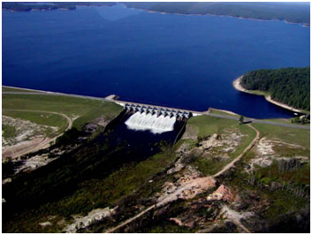
Many of the 'lakes' Texans know best are reservoirs created by dams on rivers and tributaries. Lake Travis is the Colorado River. Canyon Lake is the Guadalupe held behind a dam. Lake Texoma stores Red River water. Toledo Bend sits on the Sabine. Reservoirs create useful storage and recreation, but they do not erase the river system underneath the map.
That matters when thinking about drought, flooding or water supply. A reservoir can fall even when your neighborhood received rain because the larger basin did not. It can rise rapidly after storms far upstream. Releases from a dam can change downstream river conditions even under a clear local sky.
Springs are part of the river story
Some Texas rivers depend heavily on groundwater. In the Hill Country and along the Balcones Fault Zone, springs can provide the steady base flow that keeps a river moving between storms. The Comal and San Marcos are dramatic examples, while spring-fed reaches also shape the Guadalupe, Frio, Nueces, Devils and other waterways.
This is why aquifer pumping and river flow can become part of the same argument. Water underground may eventually emerge at a spring. If spring flow weakens, the effects can travel downstream through swimming areas, wildlife habitat and water-supply systems.
Flood and drought are both normal Texas river behavior
Texans often talk about rivers as though one condition is normal and everything else is an exception. The better mental model is variability. Long dry periods can reduce streams to quiet pools, then intense rainfall can send enormous volumes of water through the same channel.
Hill Country rivers can rise with frightening speed because steep terrain, thin soils and exposed rock shed water quickly. Broad coastal and East Texas rivers can spread across floodplains and remain high longer. Urban watersheds add pavement and rooftops that move rainfall into drainage systems faster than undeveloped land would.
A dry crossing, gravel bar or low bank is therefore not proof that a river cannot reach it. The shape of a floodplain is evidence of where water has gone before.
How to read a Texas river when you visit
- Look upstream on the map. The water in front of you is the result of everything happening in the basin above you.
- Notice the rock and soil. Limestone often produces a different river shape and clarity than sandy or muddy coastal-plain geology.
- Check whether a reservoir controls the reach. Dam releases can change flow and temperature downstream.
- Look for springs and tributaries. A small side stream can explain why a river suddenly becomes clearer, colder or larger.
- Treat flood warnings and access rules as local knowledge, not inconvenience. Texas rivers can change much faster than a travel photo suggests.
- Respect private property. Public water does not automatically mean every bank, road or access point is public.
The best way to understand Texas is one river at a time
A statewide river map is useful, but the real opportunity is to follow these systems more closely. The Brazos can become a story about Washington-on-the-Brazos, Possum Kingdom country, agricultural bottomlands and Gulf Coast history. The Colorado can become a chain of pieces on the Highland Lakes, the Llano and Pedernales, Austin and Matagorda Bay. The Guadalupe opens into stories about Kerr County, Canyon Lake, New Braunfels, the Comal and San Marcos.
The same is true across the state. The Rio Grande can be followed through El Paso, Big Bend, Amistad, Falcon and the Valley. The Neches and Sabine can introduce the Piney Woods and East Texas reservoirs. The Nueces leads naturally to the Frio, Choke Canyon and the Coastal Bend.
That is why rivers make such a useful way to organize Texas. They connect places that look unrelated on a highway map and reveal why towns, farms, parks, reservoirs and cities are where they are. Follow the water long enough and the state stops looking like a collection of separate destinations. It starts looking connected.
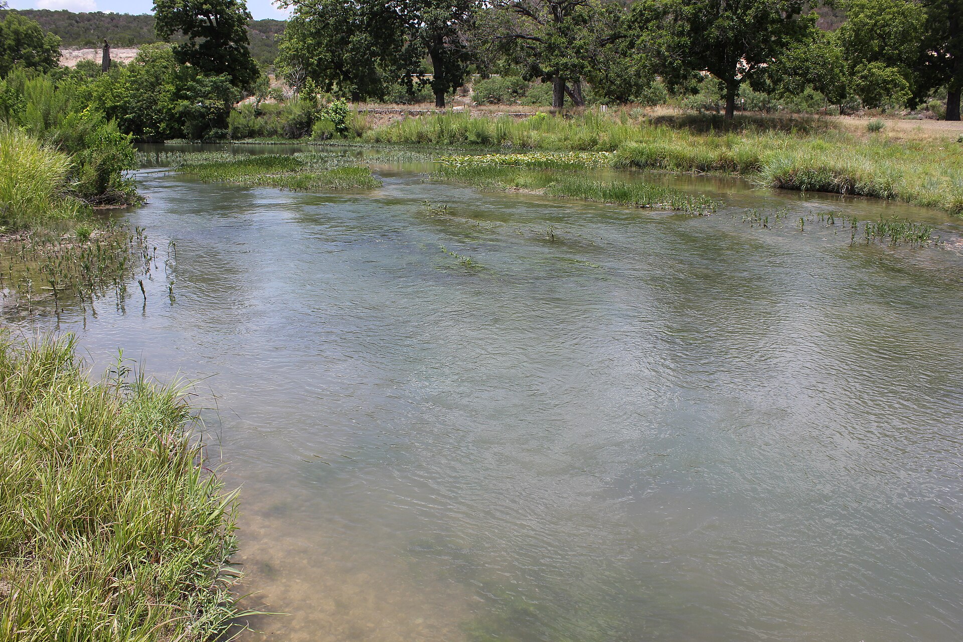
Image credit: Larry D. Moore · CC BY 4.0 · Wikimedia Commons
Primary source: Texas Water Development Board ↗
Filed under
- major rivers in texas
- texas river basins
- texas rivers map
- rio grande
- brazos river
- colorado river texas
- guadalupe river
- trinity river texas
- texas geography
- texas water
Plan the trip
Places connected to this story
Destinations explicitly tied to this article in the Texas Defined guide.
Spring Branch · Comal County
Guadalupe River State Park
Four miles of Guadalupe River frontage between San Antonio and the Hill Country, pairing cypress-lined swimming and paddling water with trails, camping and access to the protected Honey Creek landscape.
Best season: Late spring through early fall for river time; fall through spring for comfortable hiking- Four miles of Guadalupe River frontage
- Swimming, tubing, paddling and fishing when river conditions allow
- Hill Country trails through prairie, oak woodland and river corridor
Del Rio · Val Verde County
Devils River State Natural Area
A remote, exceptionally clear spring-fed river natural area in Southwest Texas with two reservation-only units—Del Norte and Dan A. Hughes—protecting rugged limestone canyon country and primitive backcountry access.
Best season: Spring and fall for cooler backcountry travel; summer heat is severeUpdated Aug 2026- Del Norte Unit
- Dan A. Hughes Unit
- Clear spring-fed Devils River
Junction · Kimble County
South Llano River State Park
A clear-river Hill Country park near Junction where swimming, tubing, paddling, turkey habitat, pecan bottomlands and miles of trails come together along the spring-fed South Llano River.
Best season: Spring and fall for trails and river weather; summer for swimming and tubing with heat precautionsUpdated Sep 2026- South Llano River swimming and tubing
- Multiple tuber put-in and take-out points
- Paddling on the spring-fed river
From the magazine
More stories to read next
Lakes & Rivers
Toledo Bend Explained: Texas' Largest Reservoir and a Two-State Water Project
August 16, 2026 · About 9 minutes
Lakes & Rivers
Possum Kingdom Lake Explained: An Early Brazos River Multipurpose Reservoir
August 16, 2026 · About 9 minutes
Lakes & Rivers
Lake Whitney Explained: A Brazos River Reservoir Built for Multiple Jobs
August 16, 2026 · About 9 minutes