Texas Explained
Why Almost All Texas Lakes Are Man-Made
Quick answer
The short version
Texas looks like a lake-rich state on the map, but nearly every familiar inland lake is really a river or creek held behind a dam. The reason is a Texas story about drought, floods, fast-growing cities and the enormous water system built between them.
Read the full guide ↓Look at a highway map of Texas and the state appears to be covered with lakes. Lake Travis, Lake Texoma, Lake Livingston, Sam Rayburn Reservoir, Canyon Lake, Lake Conroe, Lake Meredith and dozens more seem to fill nearly every region. It is easy to assume that Texas simply inherited an abundance of natural lakes.
It did not. Almost all of the inland lakes Texans know are reservoirs: sections of rivers and creeks impounded by dams. Texas Parks and Wildlife teaches the point plainly in its aquatic-science material, and the Texas Water Development Board maintains a statewide inventory of major reservoirs. The familiar blue shapes on the map are, in large part, infrastructure.
“Texas did not begin with a landscape full of big lakes. Texans built a lake system to manage a landscape full of unpredictable water.”
Why Texas has so few large natural lakes
The absence of large natural lakes begins with geology. Many of the world's famous natural lakes occupy basins carved by glaciers, blocked by landslides, formed by volcanic activity or created by major tectonic movement. Texas has not had the same recent glacial history that left lake-filled landscapes across parts of the northern United States and Canada.
Texas certainly has natural ponds, oxbow lakes, playa lakes, coastal lagoons and other natural bodies of water. Rivers also abandon old channels and leave curved oxbows behind. But those features are different from the large permanent inland lakes most people picture when they hear the word lake.
The best-known exception is Caddo Lake in East Texas and Louisiana. Its natural origins are associated with log jams and the complicated hydrology of the Red River and Cypress Bayou system. Even Caddo is not untouched wilderness in a hydrologic sense: dams and other human alterations have helped regulate its water level. That makes Caddo both the famous natural-lake exception and a reminder that the line between natural water body and managed water body can become blurry.
What turns a Texas river into a lake
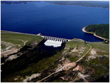
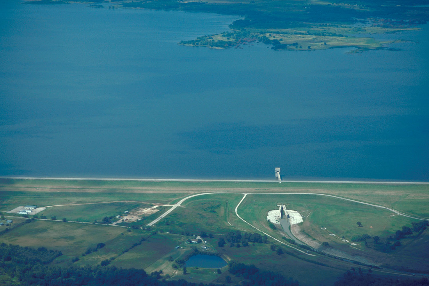
A reservoir begins with a dam. Engineers build a barrier across a river, creek or drainage. Water backs up behind it, spreading across the valley until the new pool reaches its operating level. Tributaries that once joined a flowing river now empty into arms and coves. Hills become peninsulas and islands. Roads, farms and former bottomlands may disappear beneath the new waterline.
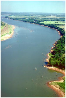
The river does not stop being a river just because the map label changes. Lake Travis is part of the Colorado River system. Canyon Lake impounds the Guadalupe. Lake Texoma sits on the Red River. Lake Livingston impounds the Trinity. Toledo Bend occupies the Sabine River along the Texas-Louisiana line. Amistad and Falcon are enormous reservoirs on the Rio Grande.
That is why reservoir levels respond to events far beyond the shoreline. Rain falling many counties upstream may eventually raise a lake. A dry local month may matter less than whether the watershed above the reservoir received rain. Dam releases can change river conditions downstream even when the sky at the lake is clear.
Texas needed a way to save floodwater for dry years
Texas has always had a timing problem with water. Rainfall varies enormously across the state and from year to year. West Texas can go long periods with very little rain while East Texas receives far more. Even in wetter regions, a large share of annual rainfall can arrive in a handful of storms.
That creates an uncomfortable pairing: drought and flood can be normal parts of the same water system. A river may run low for months and then carry a destructive flood after intense rain. Without storage, much of that floodwater continues downstream and eventually reaches the Gulf while communities face another dry period later.
Reservoirs change the timing. They capture some of the water moving through a basin and hold it for later use. The Texas Water Development Board notes that reservoirs provide more than half of the state's available surface-water supply. In practical terms, that stored water is what allows many cities, industries and farms to keep functioning when rivers themselves are low.
Flood control came first for many early major reservoirs
The first big wave of reservoir building was not only about drinking water. Flood control was a dominant reason many major projects were built, especially before the middle of the twentieth century. Dams could reduce the peak of downstream floods by temporarily holding water and releasing it more gradually.
The purpose of a reservoir is visible in the way it is operated. A water-supply reservoir tries to preserve usable storage. A flood-control reservoir needs room to catch incoming floodwater. A multipurpose project must balance several goals at once, sometimes including municipal supply, flood control, hydropower, irrigation, recreation and environmental releases.
Those goals can conflict. Keeping a reservoir completely full may sound ideal to boaters and waterfront homeowners, but flood-control operations may require unused capacity. Holding every drop may sound ideal during drought, but downstream users and ecosystems may depend on releases. A reservoir is therefore not simply a giant tank. It is a managed part of an entire river basin.
The mid-century drought changed the scale of Texas water planning
The drought of the 1950s became a defining event in modern Texas water history. Communities saw how vulnerable growing cities and agricultural regions could be when dry conditions persisted for years. Water supply became an even larger reason to build storage.
Reservoir construction accelerated dramatically in the decades that followed. The Texas Water Development Board's reservoir history shows especially heavy construction activity in the 1960s and 1970s. Much of the lake geography Texans now treat as permanent scenery dates from that relatively recent infrastructure era.
That changes the way you read old photographs and maps. A town photographed in 1930 may sit beside a river valley that later became a broad reservoir. A ranch road may end today at a marina because the landscape beyond it was flooded decades after the road was laid out. In many places, the 'natural-looking' shoreline is younger than the grandparents of people using it.
The Highland Lakes are one river turned into a chain of lakes
Central Texas offers one of the clearest examples. The Lower Colorado River Authority's Highland Lakes system is a series of reservoirs along the Colorado River and its connected water-management network. Lake Buchanan, Inks Lake, Lake LBJ, Lake Marble Falls, Lake Travis and Lake Austin appear to be separate lakes on a road map, but hydrologically they are pieces of one managed river system.
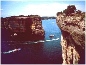
Each reservoir has its own shoreline character and recreational identity, yet water moves through the chain. Lake Travis can rise dramatically after major inflows from the upper watershed and fall during prolonged drought. The lake's famous limestone coves are not proof of a naturally flooded basin; they are the shape of Hill Country terrain submerged behind Mansfield Dam.
North Texas is surrounded by reservoirs because millions of people need stored water
The Dallas-Fort Worth region provides another lesson. North Texas does not sit beside a giant natural lake capable of serving a modern metropolitan area. Instead, the region depends on a network of reservoirs spread across several river basins.
Names such as Lewisville Lake, Grapevine Lake, Ray Roberts Lake, Lavon Lake, Lake Ray Hubbard, Cedar Creek Reservoir, Richland-Chambers Reservoir, Eagle Mountain Lake and Lake Bridgeport are part of the practical geography of urban water. Some are close to the population they serve; others move water long distances through pipelines and treatment systems.
Recreation grew around the same infrastructure. Sailing clubs, marinas, campgrounds, fishing guides and lakeside subdivisions turned water-supply projects into cultural landscapes. That is one reason Texans often experience a reservoir simply as a lake: after a few generations, the infrastructure becomes scenery.
East Texas has the state's biggest reservoir landscapes
Higher rainfall and larger river flows make East Texas a natural place for very large reservoirs. Toledo Bend Reservoir on the Sabine River stretches along the Louisiana border and is among the largest reservoirs in the country by surface area. Sam Rayburn Reservoir on the Angelina River anchors another enormous recreation and water-management landscape.
Lake Livingston on the Trinity and Lake Conroe on the West Fork of the San Jacinto are deeply tied to the Houston region. Lake Livingston is especially important as a major water source. The fact that these lakes sit in humid, forested country can make them look more naturally inevitable than a reservoir in West Texas, but their shorelines still exist because dams hold rivers back.
West Texas reservoirs make the engineering even easier to see
In drier country, the contrast between reservoir and surrounding landscape can be dramatic. Lake Meredith stores Canadian River water in the Panhandle. Amistad spreads across desert canyons on the Rio Grande. Falcon Reservoir serves the lower Rio Grande region. Red Bluff Reservoir impounds the Pecos near the New Mexico line.
These lakes make a simple point: storage is most valuable where reliable water is hardest to take for granted. At the same time, arid reservoirs can lose substantial water to evaporation, and prolonged drought may expose shorelines that had been underwater for years. A reservoir solves part of the timing problem; it does not manufacture rainfall.
South and Central Texas reservoirs support cities, farms and recreation at once
Canyon Lake on the Guadalupe River is both a flood-control and water-supply project and one of Central Texas's major recreation destinations. Choke Canyon Reservoir and Lake Corpus Christi are central to the Coastal Bend water system. Medina Lake, when water levels allow, is a familiar recreational landmark west of San Antonio while also reflecting the region's long history of irrigation and water management.
The multiple-use nature of these reservoirs explains many local debates. Boaters care about ramps and water levels. Cities care about supply. Farmers care about releases. Property owners care about shoreline access. Flood managers care about incoming storms. Wildlife managers care about habitat and downstream flows. Everyone may be talking about the same lake while meaning something different by 'healthy.'
Why some are called lakes and others reservoirs
The words lake and reservoir are not reliable clues to origin. Lake Travis is a reservoir. Lake Texoma is a reservoir. Canyon Lake is a reservoir. Sam Rayburn Reservoir is also a reservoir; its name simply says so.
In everyday Texas usage, 'lake' often sounds friendlier and more recreational, while 'reservoir' sounds technical or utilitarian. Naming traditions vary by agency, community and project. The underlying test is not the label. If a dam created the permanent pool by impounding a stream or river, the body of water is a reservoir regardless of what the sign at the boat ramp calls it.
A reservoir has an invisible landscape underneath it
Every large impoundment creates a before-and-after geography. Before the dam, there was a river channel, floodplain, tributary network, roads, property lines and often homes or farms. After filling, the former valley becomes the lake floor.
That is why reservoir shorelines can have strange shapes. Long narrow arms often trace tributary valleys. Deep water may follow the old river channel. A sudden point or cove can mirror terrain that was obvious before flooding. Anglers routinely use old creek channels, roadbeds and submerged structure because the pre-reservoir landscape still influences fish habitat.
Thinking this way makes a lake map easier to understand. What looks like a random blue shape is really a topographic map filled with water to a particular elevation.
Reservoir levels are supposed to move
Texans often talk about a lake being 'down' as though the reservoir is malfunctioning. Sometimes low levels are a serious drought signal, but fluctuation itself is normal. Inflows change with rainfall. Cities withdraw water. Farmers and industries may use stored supply. Operators release water downstream. Evaporation removes water directly from the surface.
A reservoir's conservation pool is the portion generally used for water supply and other regular purposes. Some projects also reserve flood-storage space above normal operating levels. During major storms, the lake may rise into that flood pool and later be drawn back down through controlled releases.
The exact operating rules differ from lake to lake, which is why a statewide percentage can never tell you everything about a particular reservoir. A small water-supply lake and a giant multipurpose federal reservoir may respond very differently to the same season.
The lake is infrastructure, but the ecosystem becomes real
Calling a reservoir man-made does not mean it lacks ecological value. Once flooded, reservoirs create extensive aquatic habitat. Fisheries develop. Shoreline wetlands form. Migrating birds use open water and coves. Parks and wildlife-management areas grow around the new shoreline.
But reservoirs also transform the original river ecosystem. A free-flowing channel becomes deep standing water. Sediment settles behind dams. Water temperature can change. Fish movement may be blocked. Downstream flow patterns no longer match the pre-dam river exactly.
That dual identity is important. A Texas reservoir can be both critical public infrastructure and a functioning ecosystem; both a beloved recreation area and a permanently altered river valley.
Texas is not building giant reservoirs at the pace it once did
The great reservoir-building era slowed after the 1960s and 1970s. The Texas Water Development Board has pointed to several reasons: the best dam sites are limited, projects are expensive, environmental review is more complex and permitting can be difficult. New reservoirs still appear in long-range water plans, but building one is a much larger undertaking than drawing a blue shape on a planning map.
That makes existing reservoirs increasingly important. Maintaining dams, protecting storage capacity from sediment, coordinating water rights and moving water efficiently can matter as much as building something new. Texas is also expanding other strategies, including groundwater management, conservation, reuse, desalination and transfers between systems.
How to read a Texas lake like a Texan
- Find the dam. It immediately tells you which end of the lake is deepest and confirms that the lake is an impoundment.
- Find the river. The old channel usually forms the lake's main spine, even when it is hidden beneath deep water.
- Look upstream. Reservoir conditions depend on rainfall across the watershed, not just weather at the marina.
- Check who operates it. Federal agencies, river authorities, cities and water districts can have different missions and operating rules.
- Do not assume a full lake is always the sole goal. Flood-control space, downstream releases and water-supply strategy can require changing levels.
- Treat exposed shoreline during drought as temporary geography. A ramp, road or old foundation visible today may be underwater again after the next wet cycle.
- Remember that recreation is often a secondary benefit of infrastructure built first for water supply, flood control or both.
The lake map is really a map of how Texas learned to live with water
Texas reservoirs are so familiar that they feel ancient. Families have vacationed on them for generations. Towns market themselves around them. Waterfront neighborhoods, state parks and fishing traditions have grown into mature local cultures.
Yet most of the big inland lakes on today's map are engineered landscapes created within modern Texas history. Their existence records a statewide decision: if rainfall arrives at the wrong time and rivers cannot be trusted to stay steady, save the water when it comes.
That is why Texas has so many lakes without having many natural lakes. The state built reservoirs across its river basins until water infrastructure became part of the scenery. Once you see that, the map changes. Lake Travis becomes the Colorado River held in limestone hills. Canyon Lake becomes the Guadalupe stored behind a dam. Texoma becomes the Red River widened into a border lake. The blue shapes stop being isolated destinations and start revealing the water system that keeps Texas running.
Primary source: Texas Water Development Board ↗
Filed under
- texas lakes
- texas reservoirs
- water supply
- texas dams
- caddo lake
- lake travis
- texas water
- texas geography
From the magazine
More stories to read next
Lakes & Rivers
Toledo Bend Explained: Texas' Largest Reservoir and a Two-State Water Project
August 16, 2026 · About 9 minutes
Lakes & Rivers
Possum Kingdom Lake Explained: An Early Brazos River Multipurpose Reservoir
August 16, 2026 · About 9 minutes
Lakes & Rivers
Lake Whitney Explained: A Brazos River Reservoir Built for Multiple Jobs
August 16, 2026 · About 9 minutes