Texas Explained
Lake Travis Explained: Austin's Flood-Control and Water-Storage Reservoir
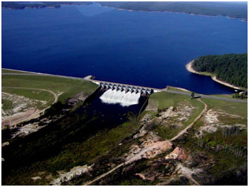
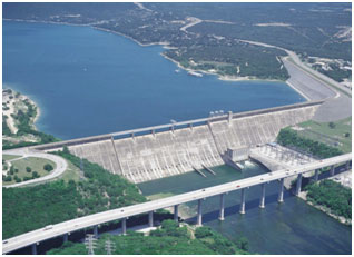
Lake Travis sits just upstream from Austin, but its role reaches far beyond recreation. Mansfield Dam stores Colorado River water, provides flood-control space and operates as part of a larger chain of LCRA reservoirs.
Lake Travis is one of the most visible pieces of Central Texas water infrastructure because Austin has grown around it. Homes, marinas and recreation dominate the public image, but Mansfield Dam was built to manage a much larger Colorado River problem: how to store water, reduce flood risk and make river flows more useful across time.
A reservoir designed for both storage and floods
TWDB says Lake Travis and Mansfield Dam are owned and operated by the Lower Colorado River Authority for flood control, water supply, electric-power generation and recreation. Those purposes require different kinds of space and operating decisions, which is why the reservoir has both conservation-storage and flood-storage concepts.
The dam changed from Marshall Ford to Mansfield
Construction began in 1937 at a Colorado River crossing known as Marshall Ford. The project was expanded, deliberate impoundment began in 1940 and the dam was later renamed for U.S. Rep. J.J. Mansfield. TWDB records the present structure as a combination of concrete, earth and rockfill construction.
Lake Travis does not operate alone
TWDB notes that runoff reaching Lake Travis is partly regulated by Lake Buchanan and other reservoirs upstream. That is one of the most important facts about the Highland Lakes: the amount and timing of water at Travis reflect both watershed conditions and decisions made elsewhere in the connected reservoir chain.
Why the lake can rise and fall so dramatically
A reservoir is not maintained simply for a constant shoreline. Lake Travis stores conservation water and also provides flood-storage capacity above that level. In a variable Texas climate, inflow can swing widely between drought and major storms, while releases and evaporation continue to change storage.
That variability is not evidence that the lake has stopped functioning. It is part of what a multipurpose reservoir is built to handle: different hydrologic conditions while preserving room for supply and flood-management objectives.
What Lake Travis teaches about Austin's water map
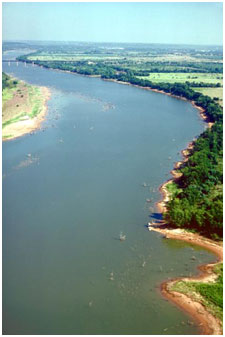
- The lake is part of the Colorado River, not a separate water body disconnected from upstream events.
- Flood-control space and water-supply storage can coexist in the same reservoir.
- Lake Buchanan and other upstream reservoirs influence inflow timing at Travis.
- Shoreline conditions can vary because reservoir operation follows water conditions rather than a fixed recreational level.
- Austin's growth sits beside infrastructure created decades before today's metropolitan scale.
A lake best understood as infrastructure
Lake Travis can be a recreation destination and a critical water-management structure at the same time. Reading it as infrastructure explains why Mansfield Dam, upstream reservoirs, flood space and conservation storage matter more than any single snapshot of the shoreline.
Image credit: Texas Water Development Board reservoir record
Primary source: Texas Water Development Board ↗
Filed under
- Lake Travis
- Mansfield Dam
- Highland Lakes
- Colorado River
- Austin water
- LCRA
From the magazine
More stories to read next
Lakes & Rivers
Toledo Bend Explained: Texas' Largest Reservoir and a Two-State Water Project
August 16, 2026 · About 9 minutes
Lakes & Rivers
Possum Kingdom Lake Explained: An Early Brazos River Multipurpose Reservoir
August 16, 2026 · About 9 minutes
Lakes & Rivers
Lake Whitney Explained: A Brazos River Reservoir Built for Multiple Jobs
August 16, 2026 · About 9 minutes