Texas Explained
Texas Aquifers and Springs Explained: The Water Beneath the State
Rivers and reservoirs are only the visible part of Texas water. Aquifers store groundwater beneath the surface, springs bring some of it back into daylight, and both shape cities, farms, wildlife and land decisions.
Texas water is not only stored behind dams or flowing between riverbanks. A huge part of the state's water story is underground, inside aquifers: water-bearing formations of rock, sand, gravel or other geologic material that can store and transmit groundwater. The Texas Water Development Board recognizes nine major and 22 minor aquifers, which means the groundwater map is far more complicated than a single underground reservoir beneath the state.
Groundwater is also not a niche resource. TWDB's 2020 water-use accounting found that groundwater supplied about 55 percent of the water used in Texas. Municipal systems, farms, ranches, industries and individual rural households all depend on it, but the share and the aquifer involved change dramatically from one region to another.
What an aquifer actually is
An aquifer is not usually an underground lake or giant hollow cavern. Water occupies pores, fractures and openings in geologic formations. The amount of water available, how quickly it moves and how easily a well can produce it depend on the formation itself. Sand and gravel aquifers behave differently from fractured limestone, and a formation that yields dependable water in one county may become deeper, saltier or less productive farther along its extent.
That is why aquifer names are useful but incomplete. Knowing that a property overlies the Trinity, Carrizo-Wilcox, Edwards or Ogallala Aquifer gives you regional context, not a guaranteed well depth or yield. Groundwater questions eventually have to move from the statewide map to local well records, water levels, geology and professional site-specific information.
Outcrop, recharge and confined groundwater
TWDB aquifer maps distinguish areas where water-bearing formations reach the surface from areas where those formations dip beneath other layers. Where an aquifer is exposed at the surface, rainfall and streamflow can enter the formation more directly. These outcrop areas are important recharge zones, and because the groundwater is closer to the surface they can also be more vulnerable to contamination.
Farther downdip, an aquifer may be covered by less-permeable layers and become confined. Water there can be under pressure, which is why some wells historically flowed without pumping. The important practical point is that the same named aquifer can behave differently depending on whether you are in its recharge zone, its confined portion or near a boundary where water quality and productivity change.
Why springs appear where they do
A spring forms where groundwater naturally reaches the land surface. That can happen where an aquifer intersects a hillside, river channel, fault, fracture or other geologic boundary. In parts of Central Texas, large springs have helped sustain rivers, swimming holes, ecosystems and communities for generations. San Marcos Springs, Comal Springs and Barton Springs are famous because they make an underground water system visible.
Spring flow is one visible sign that groundwater and surface water are connected. Rainfall and recharge can increase spring flow, while drought and pumping can reduce it. The exact relationship varies by aquifer and spring system, so a clear pool should not be mistaken for an unlimited supply. A spring can look permanent over a human lifetime and still respond sharply to changes in the groundwater system feeding it.
The Edwards and Ogallala show two very different Texas water stories
The Edwards Aquifer is famous for karst limestone, major springs and its importance to Central Texas communities and ecosystems. Water can move relatively quickly through fractures, caves and conduits in parts of the system, which is one reason recharge-zone protection and contamination concerns receive so much attention.
The Ogallala Aquifer underlies much of the High Plains and has supported large-scale agricultural irrigation. TWDB water-use data show how dominant it is in Texas irrigation groundwater use. The central challenge there is different from the spring-fed Edwards story: long-term withdrawals can exceed recharge in portions of the aquifer, making water-level trends an essential part of agricultural and community planning.
Groundwater does not follow county lines
Aquifers cross city and county boundaries, just as river basins do. Pumping in one jurisdiction occurs inside a geologic system that can extend across many others. Texas addresses that reality through groundwater management areas, groundwater conservation districts and other planning structures, but the physical aquifer remains larger than any local boundary drawn on a tax map.
For residents, that means the county name alone is rarely enough to answer a groundwater question. Two properties in the same county can sit over different formations or different parts of the same aquifer. Two neighboring counties may depend on the same regional groundwater source. The useful research sequence is aquifer, local district if one exists, nearby well data, and then parcel-specific investigation.
Groundwater quality changes with geology
Groundwater can contain naturally occurring minerals and dissolved solids picked up from the formations it moves through. Quality can change with depth and location, and some aquifers become too mineralized for ordinary freshwater use in their deeper or downdip portions. That is why a mapped aquifer should never be read as a statewide promise of identical drinking water.
For a municipal system, treatment and monitoring happen at the utility level. For a private well, the owner is responsible for understanding the water source and appropriate testing. Clear water, good taste and a neighbor's experience are useful observations, but they are not substitutes for records and testing when a household or land purchase depends on the well.
Why this matters for land, cities and drought
- Some Texas communities rely heavily on groundwater for municipal supply, while others rely mostly on reservoirs or a mixture of both.
- Rural properties may depend on private wells, making groundwater depth, yield, quality and local rules part of real-estate due diligence.
- Spring-fed rivers can depend on groundwater conditions as well as recent rain, so drought can affect recreation and habitat even when a river still looks clear.
- Aquifer depth, productivity and water quality can vary substantially within the same broad region.
- Groundwater conservation districts may regulate certain wells and pumping in their jurisdictions, so proposed uses should be checked locally.
- Long-term groundwater levels matter because today's producing well does not by itself describe future conditions.
How to read the groundwater map without overpromising
Start with the TWDB aquifer map to identify the likely regional system. Then check whether the site lies on an outcrop or downdip portion, whether a groundwater conservation district covers the location, and what nearby well records show about depth and construction. If the decision involves buying land, drilling a new well or supporting high water demand, bring in a qualified local professional rather than converting a statewide map into a parcel-level guarantee.
Aquifers complete the Texas water map
Reservoirs explain stored surface water. River basins explain where runoff flows. Aquifers explain the hidden storage below ground, and springs reveal places where those underground systems reconnect with the surface. Understanding all three gives a far more complete picture of why water availability differs across Texas—and why the same drought can look very different in a reservoir town, a spring-fed community and a High Plains farming county.
Image credit: Larry D. Moore · CC BY 4.0 · Wikimedia Commons
Primary source: Texas Water Development Board ↗
Filed under
- texas aquifers
- texas springs
- groundwater
- Edwards Aquifer
- Ogallala Aquifer
- TWDB
Plan the trip
Places connected to this story
Destinations explicitly tied to this article in the Texas Defined guide.
Spring Branch · Comal County
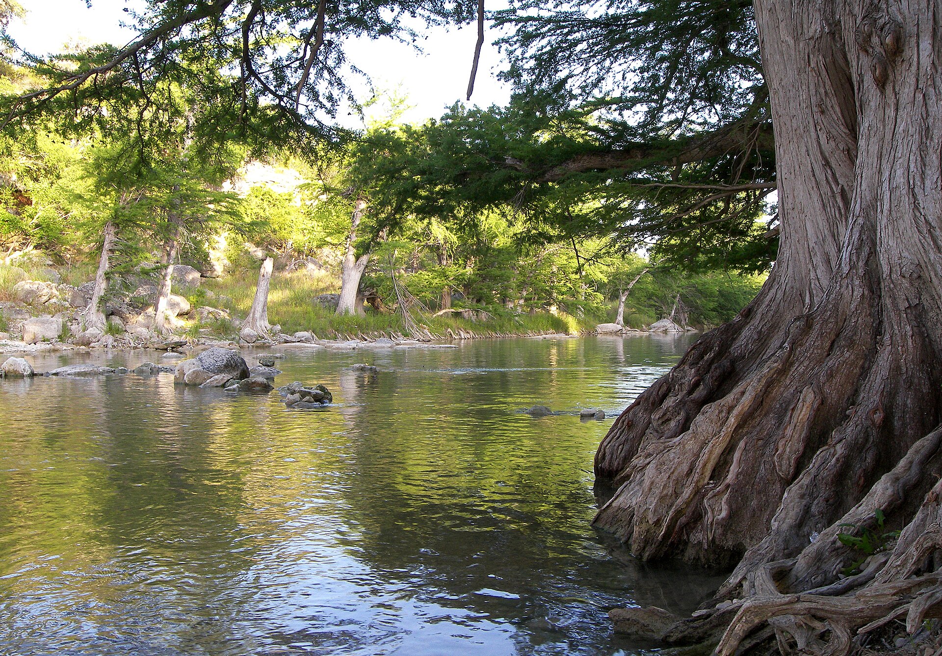
Guadalupe River State Park
Four miles of Guadalupe River frontage between San Antonio and the Hill Country, pairing cypress-lined swimming and paddling water with trails, camping and access to the protected Honey Creek landscape.
Best season: Late spring through early fall for river time; fall through spring for comfortable hiking- Four miles of Guadalupe River frontage
- Swimming, tubing, paddling and fishing when river conditions allow
- Hill Country trails through prairie, oak woodland and river corridor
From the magazine
More stories to read next
Lakes & Rivers
Toledo Bend Explained: Texas' Largest Reservoir and a Two-State Water Project
August 16, 2026 · About 9 minutes
Lakes & Rivers
Possum Kingdom Lake Explained: An Early Brazos River Multipurpose Reservoir
August 16, 2026 · About 9 minutes
Lakes & Rivers
Lake Whitney Explained: A Brazos River Reservoir Built for Multiple Jobs
August 16, 2026 · About 9 minutes