moving to texas
Texas Cities and Regions: How Houston, DFW, Austin, San Antonio and the Rest Really Differ
The state is too large for one Texas lifestyle. Compare the major metros, Hill Country, Rio Grande Valley, Panhandle, Piney Woods, Gulf Coast and West Texas before deciding where you fit.
Choosing a place to live in Texas is less like choosing a neighborhood inside one state and more like choosing among several different regional systems. Houston and El Paso do not share a climate. Dallas and Fort Worth share a metro economy but deliberately maintain different identities. Austin can be geographically close to San Antonio while feeling very different in housing, politics, technology employment and daily rhythm.
The state also contains places that do not revolve around the big metros at all: the Rio Grande Valley, Panhandle, Piney Woods, Hill Country, Coastal Bend and Big Bend country. The correct question is not 'What is the best city in Texas?' It is 'Which tradeoffs fit the way my household actually lives?'
Houston: enormous, diverse and organized around multiple job centers
Houston is the largest city in Texas and the core of a much larger metropolitan area. Energy, medicine, ports, aerospace, manufacturing and international business give the region an unusually broad employment base. Its food culture reflects decades of immigration from Latin America, Asia, Africa, the Middle East and beyond.
The physical experience is sprawl. Downtown is only one center among many: the Texas Medical Center, Uptown, Energy Corridor, Greenway, Westchase and suburban employment centers can all matter to a commute. A home that is 'in Houston' tells you very little until you know where the job is.
Houston is famous for not using conventional Euclidean zoning, but that does not mean 'no land-use rules.' Deed restrictions, development ordinances, floodplain rules, parking standards and other regulations still shape property. The practical result is a city where commercial and residential uses can sometimes sit much closer together than newcomers expect.
Heat, humidity, heavy rain and hurricane risk belong in the housing decision. Drainage and insurance can matter as much as school ratings.
Dallas: corporate scale, finance and a polished urban-suburban network
Dallas is a major center for corporate headquarters, finance, professional services, health care, technology, retail and real estate. The city has a more corporate reputation than many Texas metros, but the region is too large to reduce to one personality.
North Dallas, Plano, Frisco, Irving, Las Colinas, Richardson and other employment centers mean that a 'Dallas job' may never require commuting to downtown Dallas. Housing decisions should follow the actual office location and toll-road pattern.
Housing costs vary sharply. Premium inner neighborhoods and fast-growing northern suburbs can be expensive, while other parts of the Metroplex offer very different price points.
Fort Worth: part of DFW, not a suburb of Dallas
Fort Worth shares the Metroplex economy and airport network but maintains a distinct western and industrial identity. The Stockyards, rodeo culture, museums, defense and aviation employers, rail and logistics all contribute to a city that often feels less corporate and more explicitly connected to cattle and Western history.
For movers, the difference matters because Dallas and Fort Worth sit far enough apart that treating them as interchangeable commute endpoints is a mistake.
DFW is a region made of dozens of real cities
'DFW' is useful shorthand for an enormous connected labor and housing market. It includes Dallas, Fort Worth, Arlington, Plano, Frisco, Irving, Garland, Grand Prairie, McKinney and many more independent municipalities. Each can have its own school districts, utilities, police, tax rates, development patterns and local politics.
DFW International Airport gives the region exceptional domestic and international access, while Dallas Love Field adds another major commercial option. That connectivity is one reason headquarters, logistics and business travel are so deeply embedded in the region.
Austin: technology, government, music and a constrained central corridor
Austin combines state government, the University of Texas, technology, semiconductors, startups, music and outdoor culture. Lakes, greenbelts and Hill Country terrain give the city a scenic identity that feels different from flatter Texas metros.
The tradeoff is cost and transportation. Housing became expensive relative to many Texas alternatives, and the region's highway network can funnel large numbers of commuters through a limited set of corridors. A short-looking distance across Austin can become a long peak-hour drive.
Austin also has a more progressive political reputation than most of the state. That is a civic characteristic, not a complete description of every resident or suburb.
San Antonio: history, military, families and a strong Mexican American identity
San Antonio's identity is tied to Mexican and Tejano history, the missions, the River Walk, military installations, health care, tourism and a large family-oriented metro. Compared with Austin, it often offers more housing for the money, though prices vary widely by neighborhood and suburban corridor.
Joint Base San Antonio makes the military unusually visible in everyday life. Fiesta, neighborhood food traditions and historic districts give the city a civic culture that is distinct even from other South Texas communities.
El Paso: desert mountains, border culture and Mountain Time
El Paso sits at the far western edge of Texas beside New Mexico and Chihuahua, Mexico. The Franklin Mountains divide the city visually and geographically, while the Rio Grande and international border shape trade, family ties and culture.
It operates on Mountain Time, one of the simplest reminders that Texas spans an enormous distance. The climate is far drier than Houston or East Texas, and desert mountain scenery is part of daily life rather than a weekend excursion.
El Paso has often posted lower violent-crime rates than outsiders expect for a major border city, but safety comparisons should use current neighborhood-level and agency data rather than a permanent label like 'exceptionally safe.'
The Hill Country: a region, not one suburb of Austin
The Hill Country covers limestone hills, springs, ranch roads, wineries, state parks and historic towns across Central Texas. Fredericksburg, Kerrville, Johnson City, Blanco, Wimberley and many smaller places have different levels of tourism and growth.
For residents, the tradeoffs include beautiful terrain and outdoor access against rising land values, water constraints, wildfire exposure in some areas and longer drives for specialized services.
The Rio Grande Valley: one connected South Texas region
The Valley is not one city. McAllen, Edinburg, Mission, Pharr, Harlingen, Brownsville and surrounding communities form a connected urban region with strong Mexican American culture, international trade, agriculture, health care, retail and a subtropical climate.
Food and family networks are central to local identity, while the border is both an everyday economic reality and a national political subject. Those are different lenses and should not be collapsed into one story.
The Panhandle: wind, agriculture and winters newcomers underestimate
Amarillo and the surrounding High Plains sit at a higher elevation than much of Texas. The landscape is open, agricultural and windy, with cattle feeding, farming and energy as major economic themes. Winters can bring snow, ice and sharp cold that surprise people who moved to Texas expecting perpetual warmth.
Palo Duro Canyon provides a dramatic exception to the flat-horizon stereotype, while Route 66 history gives Amarillo another cultural layer.
The Coastal Bend: water, wind and working ports
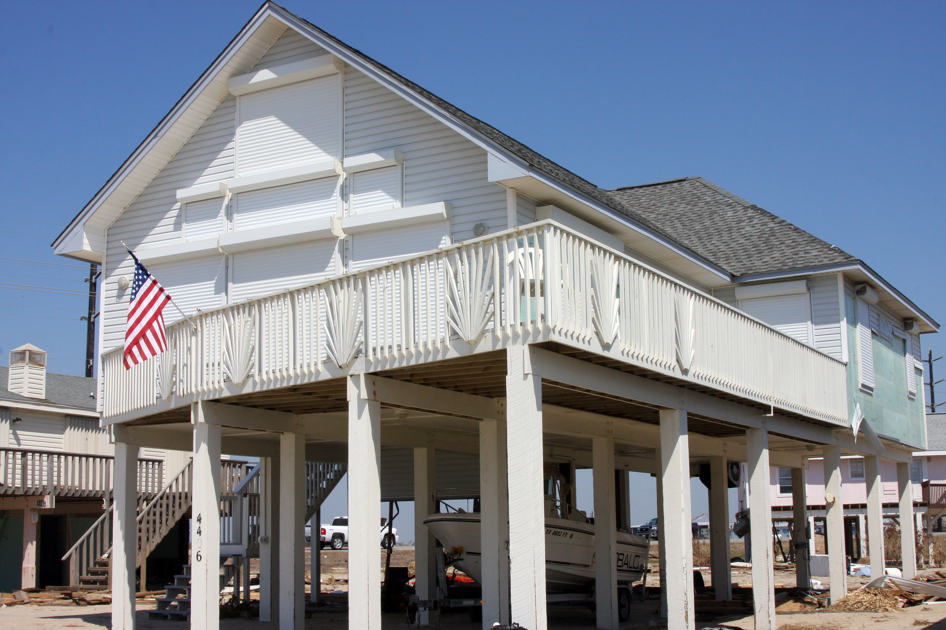
Corpus Christi and the Coastal Bend combine beaches, fishing, wind sports, naval aviation, refineries and one of the state's important port complexes. Living there is different from vacationing there: salt air, wind, flood exposure and hurricane preparation become home-maintenance issues.
South Padre Island generally has clearer water than the upper Texas coast because Gulf currents, sediment and river influence vary along the shoreline. Galveston's water can appear brown or green because of suspended sediment; color alone is not a measure of cleanliness.
The Piney Woods: forested Texas with strong Southern connections
East Texas is wooded, humid and culturally connected to the broader South. Timber, lakes, historic railroads, barbecue, church communities and older small towns distinguish the region from Central or West Texas.
The landscape changes the housing checklist too. Tree maintenance, humidity, drainage and longer rural drives can matter more here than desert wind or coastal salt.
West Texas: oil cities, ranch country, art towns and dark skies
West Texas is too large to be one thing. Midland and Odessa sit in the Permian Basin energy economy. Marfa and Alpine connect art, tourism and higher education with ranch country. Fort Davis sits beneath some of the darkest skies in the continental United States, and Big Bend pushes remoteness to another level.
Dark-sky quality is one of the region's great assets because population density and artificial light fall away dramatically in parts of the Trans-Pecos. McDonald Observatory and surrounding communities have helped make preservation of those skies part of regional identity.
German and Czech heritage is still visible in Central Texas
New Braunfels, Fredericksburg, Schulenburg, West and many other communities preserve pieces of German and Czech settlement through churches, dance halls, bakeries, festivals, language traces and architecture. The traditions have evolved, but they are not museum pieces; many still function as ordinary community life.
The geographic center is near Brady—and that explains something
Texas's geographic center is commonly placed in McCulloch County near Brady. It is nowhere near the center of the state's population or largest metros. That mismatch helps explain why statewide driving distances surprise newcomers: the places where most Texans live are concentrated east of the physical center.
Politics changes by geography too
Texas voting patterns vary sharply among urban cores, suburbs, exurbs and rural counties, and those patterns continue to change as populations move. A simplified 'cities blue, rural red' rule can describe a broad tendency without predicting every neighborhood, suburb or election.
TexasDefined treats voting patterns only as local context; election coverage and political analysis are outside this site's scope.
The best fit starts with four maps
- Job map: where are the actual employers in your field?
- Commute map: how long is the drive at the hour you will actually travel?
- School and tax map: which ISD and taxing units serve the exact address?
- Climate and hazard map: what do heat, hail, flood, wind, drought or wildfire mean for this property?
After those four maps, lifestyle becomes easier to compare. You can choose high-rise urban life, a master-planned suburb, a small courthouse town, a Gulf Coast community, a Hill Country acreage property or a West Texas desert city—but the costs and systems behind those choices are radically different.
Image credit: Leeannoneal · CC BY-SA 4.0 · Wikimedia Commons
Primary source: TexasDefined regional desk ↗
Filed under
- texas cities
- houston vs dallas vs austin
- moving to texas
- texas regions
- san antonio
- el paso
- rio grande valley
- west texas
From the magazine
More stories to read next
Moving Here
Texas vs. Florida: The Relocation Tradeoffs That Actually Matter
August 20, 2026 · About 17 minutes
Moving Here
Texas vs. California: What Changes When You Actually Move
August 20, 2026 · About 17 minutes
Moving Here
Texas Heat, Storms, Wildlife and Daily Safety: A Newcomer's Field Guide
August 19, 2026 · About 7 minutes